Click to visit the main New York Public Library Homepage
The New York Public Library
Digital Collections
About Digital Collections
Browse
Search only public domain materials
Items
Collections
Divisions
Home
Search
Browse
About
Search only public domain materials
Items
Collections
Divisions
Digital Collections
Using Images
Using Data
Collections
Charting America: Maps from the Lawrence H. Slaughter Collection and Others
Charting America: Maps from the Lawrence H. Slaughter Collection and Others
Navigation
Filters
Charting America: Maps from the Lawrence H. Slaughter Collection and Others
Previous
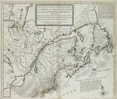
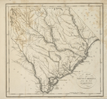
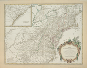
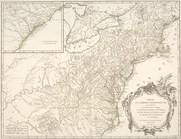
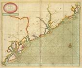
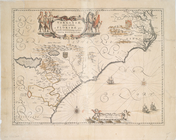
The south part of Virginia, now the north part of Carolina
0
Atlases, gazetteers, guidebooks and other books
377
Maps of the World
16
Maps of the Oceans
24
Maps of North and South America
23
Maps of North America.
551
Maps of New York City and State
1340
Lawrence H. Slaughter Collection of English maps, charts, globes, books and atlases
1020
John H. Levine Collection
60
More
Show filters
Hide filters
Show Only Public Domain
topic
Atlases, British
4
Coasts
3
Nautical charts
3
Geography
2
Harbors
2
More
Less
name
Robert de Vaugondy, Gilles, 1688-1766
3
Seller, John, active 1658-1698
3
Stockdale, John, 1749?-1814
3
Blaeu, Joan, 1596-1673
2
Blaeu, Willem Janszoon, 1571-1638
2
More
Less
collection
Lawrence H. Slaughter Collection of English maps, charts, globes, books and atlases
26
Atlases, gazetteers, guidebooks and other books
3
John H. Levine Collection
3
place
South Carolina
12
North Carolina
11
Virginia
7
Maps
6
South Atlantic States
6
More
Less
genre
Maps
32
Nautical charts
1
publisher
Chez Cóvens & Mortier
2
Printed by A. Godbid and J. Playford, for John Seller ...,
2
Printed for J. Stockdale
2
s.n.,
2
... Sold ... by Tho. Bowles, print and map-seller in St. Paul's-Churchyard
1
More
Less
division
Map Division
32
type
cartographic
32
text
1
Date Range
to
32 results found for:
South Carolina?tab=filter
Sort by:
Relevance
Title
Date created
Date digitized
Sequence
…
Carolina
, Map of
South
Carolina
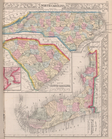
, County map
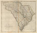
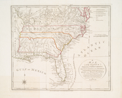
The State of
South
Carolina
, from the bests
United States of Nth. America…
A chart of Delaware Bay and R…
collection:
… and
South
Carolina
, Georgia
… of Virginia, North
Carolina
,
South
Carolina
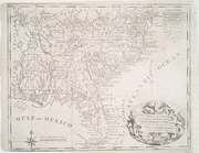
A map of
South
Carolina
, from the best
… of Virginia, North
Carolina
,
South
Carolina
note:
Kendall, H.P. Early maps of
Carolina
83.
… of the states of Georgia
South
and North
Carolina
Virginia
…, comprehending the two
Carolinas
note:
… for marches in
South
Carolina
, North
Carolina
Carte réduite du Sud des État…
abstract:
…
Carolina
,
South
Carolina
Partie de l'Amerique septentr…
note:
… to
South
Carolina
and from
Various plans and draughts of…
Carte de la Louisiane, Maryla…
abstract:
Covers the area from
South
Jersey to St
Carte de la Louisiane, Maryla…
abstract:
Covers the area from
South
Jersey to St
Partie de l'Amérique septentr…
note:
… to
South
Carolina
and from
Partie de l'Amérique septentr…
note:
… to
South
Carolina
and from
Les principales forteresses, …
note:
… of Charles Town in
South
Carolina
-- Harbour of St
m
…, Virginia and
Carolina
note:
… part of
Carolina
with the settlements &c. --
South
part
A chart of the Atlantick Ocea…
note:
… Labrador to
South
Carolina
.
…, North
Carolina
, and
South
Carolina
Carolina
newly discribed
abstract:
…
south
as coastal Georgia
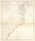
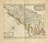
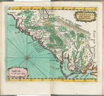
A large draft of
SOUTH
CAROLINA
from cape
Carolina
newly discribed
note:
…, and as far
south
as coastal
…, Maryland &
Carolina
, from C
m
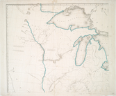
North America divided into it…
note:
….
South
Wales, N. Brittain
Carolina
, Virginia, Mary Land & New Iarsey
…, Maryland and
Carolina
note:
… and
south
to Cape Hatteras.
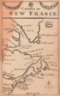
Canada, or, New France
note:
… America as far
south
as the
Carolinas
.
Virginiae partis australis et…
Virginiae partis australis, e…
Virginiae partis australis, e…
m
…, Virginia and
Carolina
note:
… part of
Carolina
with the settlements &c. -- ...
South
End of results
|
Top