Click to visit the main New York Public Library Homepage
The New York Public Library
Digital Collections
About Digital Collections
Browse
Search only public domain materials
Items
Collections
Divisions
Home
Search
Browse
About
Search only public domain materials
Items
Collections
Divisions
Digital Collections
Using Images
Using Data
Collections
Charting America: Maps from the Lawrence H. Slaughter Collection and Others
Charting America: Maps from the Lawrence H. Slaughter Collection and Others
Navigation
Filters
Charting America: Maps from the Lawrence H. Slaughter Collection and Others
Previous
The south part of Virginia, now the north part of Carolina
0
Atlases, gazetteers, guidebooks and other books
377
Maps of the World
16
Maps of the Oceans
24
Maps of North and South America
23
Maps of North America.
551
Maps of New York City and State
1340
Lawrence H. Slaughter Collection of English maps, charts, globes, books and atlases
1020
John H. Levine Collection
60
More
Show filters
Hide filters
Show Only Public Domain
topic
Administrative and political divisions
49
Railroads
30
Nautical charts
18
Harbors
15
Canals
12
More
Less
name
G.W. & C.B. Colton & Co
13
United States Coast Survey
13
G.W. & C.B. Colton & Co
12
Bache, A. D. (Alexander Dallas), 1806-1867
10
Hassler, F. R. (Ferdinand Rudolph), 1770-1843
10
More
Less
collection
Maps of New York City and State
121
Lawrence H. Slaughter Collection of English maps, charts, globes, books and atlases
17
Maps of North and South America
2
Maps of the World
2
Atlases, gazetteers, guidebooks and other books
1
place
New York (State)
96
New York (N.Y.)
27
Long Island (N.Y.)
17
Manhattan (New York, N.Y.)
16
New York
13
More
Less
genre
Maps
143
Nautical charts
11
Road maps
5
Cadastral maps
4
Bathymetric maps
3
More
Less
publisher
G.W. & C.B. Colton & Co
13
Engraved, printed and published by G.W. & C.B. Colton & Co
7
The Survey
6
publisher not identified
6
U.S. Coast Survey office
4
More
Less
division
Map Division
143
type
cartographic
143
text
1
Date Range
to
143 results found for:
Washington %28D.C.%29?tab=filter
Sort by:
Relevance
Title
Date created
Date digitized
Sequence
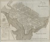
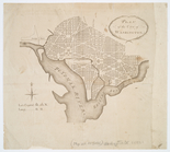
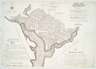
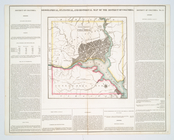
Plan de la ville de
Washington
en Amèrique
parent:
6da28670-
c
5d3-012f-ca66-58d385a7bc34
No. 1: [This map shows the po…
parent:
6ab1b910-
c
6b6-012f-b18f-58d385a7bc34
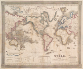
The world, on Mercator's proj…
parent:
665e6820-
c
6b6-012f-60d4-58d385a7bc34
… improvements &
c
.
parent:
b8ad9b10-
c
5a6-012f-0
c
4b-58d385a7bc34
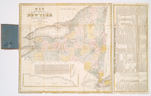
The tourist's map of the stat…
parent:
bc2aa250-
c
5a6-012f-d14
c
-58d385a7bc34
Distance map of the state of …
parent:
a202b2e0-
c
5a6-012f-9190-58d385a7bc34
Squire's map of the state of …
parent:
a202b2e0-
c
5a6-012f-9190-58d385a7bc34
[Map of] New York [State]: [S…
parent:
a3e22790-54ba-0133-6e91-00505686a51
c
Washington
city
parent:
d8b77e40-
c
5d4-012f-135f-58d385a7bc34
m
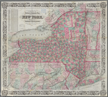
New map of the state of New Y…
parent:
5043f430-79a6-0133-1261-00505686a51
c
m
Colton's new township railroa…
parent:
3a20b3f0-79a8-0133-4f94-00505686a51
c
Colton's railroad & township …
parent:
700694b0-79a9-0133-3773-00505686a51
c
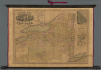
Map of New York
parent:
b7e275a0-79aa-0133-
c
3af-00505686a51
c
Colton's railroad & township …
parent:
22be6420-79ad-0133-7
c
45-00505686d14e
m
The State of New York: from n…
parent:
237cd8
c
0-7f3a-0133-4462-00505686d14e
m
New railroad, county and town…
parent:
3ad7f3a0-7ff6-0133-0ae2-00505686a51
c
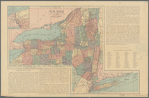
Map of the state of New York:…
parent:
f756b8d0-7ffc-0133-0418-00505686a51
c
Rand McNally & Co.'s new rail…
parent:
2f3ca610-7fff-0133-699d-00505686a51
c
Map of the state of New York …
parent:
fa9da3
c
0-8002-0133-55ed-00505686a51
c
m
Post route map of the State o…
parent:
d3bbe9
c
0-8004-0133-7648-00505686a51
c
Map of the State of New York
parent:
65276200-8017-0133-
c
215-00505686a51
c
Map of the state of New York …
parent:
3add7a50-801b-0133-6
c
48-00505686a51
c
Map of the State of New York
parent:
48e00f50-801
c
-0133-
c
37f-00505686a51
c
Mitchell's county and townshi…
parent:
2799fcc0-801f-0133-
c
8cc-00505686d14e
Railroad map of the State of …
parent:
c
762b2d0-8b16-0133-0f00-00505686a51
c
A new map of New York: with i…
parent:
4ef305
c
0-a1d0-0133-4b8e-00505686d14e
m
The State of New York: from n…
parent:
4f85f220-a
29
d-0133-aead-00505686d14e
m
The State of New York: from n…
parent:
636fed70-a2ab-0133-adf0-00505686a51
c
Colton's railroad & township …
parent:
119e25b0-2edf-0136-f3
c
2-098a5a8b588d
Territory of Columbia
parent:
e1042d90-
c
5d4-012f-9b1a-58d385a7bc34
Paterson, N.J. - N.Y., ed. of…
parent:
beae9280-
c
5a6-012f-a0b4-58d385a7bc34
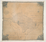
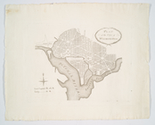
Plan of the city of
Washington
parent:
e19599
c
0-
c
5d4-012f-dd45-58d385a7bc34
Mt. Marcy, ed. of June 1902, …
parent:
ed20e900-
c
5a9-012f-041a-58d385a7bc34
Santanoni, ed. of Mar. 1904, …
parent:
19d37650-
c
5aa-012f-bea8-58d385a7bc34
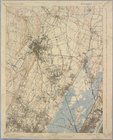
Staten Island, N.Y., ed. of F…
parent:
28db3220-
c
5aa-012f-3460-58d385a7bc34
Plan of the city of
Washington
in the territory
parent:
e22975f0-
c
5d4-012f-3b95-58d385a7bc34
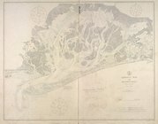
Bay and harbor of New York
parent:
3f954410-
c
5aa-012f-92bf-58d385a7bc34
Plan of the city of
Washington
.
parent:
e2a92d70-
c
5d4-012f-2a40-58d385a7bc34
Jamaica Bay and Rockaway Inle…
parent:
410b0680-
c
5aa-012f-b691-58d385a7bc34
Plan of the city of
Washington
in the territory
parent:
e378ab20-
c
5d4-012f-18cf-58d385a7bc34
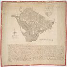
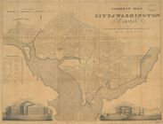
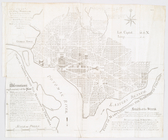
A correct map of the city of
Washington
parent:
e421
c
4b0-
c
5d4-012f-
c
7bc-58d385a7bc34
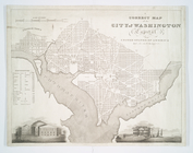
A correct map of the city of
Washington
parent:
e4
c
15150-
c
5d4-012f-d54b-58d385a7bc34
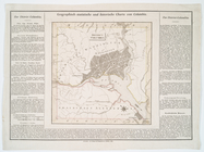
Geographical, statistical, an…
parent:
e53
c
3a80-
c
5d4-012f-512
c
-58d385a7bc34
Plan of the city of
Washington
.
parent:
e5dc9bc0-
c
5d4-012f-3899-58d385a7bc34
Plan of the city of
Washington
in the territory
parent:
e65ce5
c
0-
c
5d4-012f-1948-58d385a7bc34
United States of Nth. America…
parent:
e6ff93b0-
c
5d4-012f-b58e-58d385a7bc34
District Columbia.
parent:
e78a17d0-
c
5d4-012f-62a4-58d385a7bc34
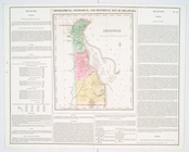
Delaware
parent:
0f9f3180-
c
5d5-012f-0335-58d385a7bc34
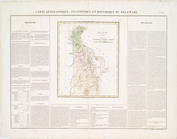
Delaware.
parent:
119baa90-
c
5d5-012f-99f7-58d385a7bc34
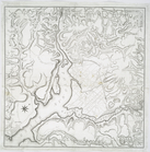
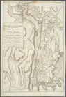
A plan of the operations of t…
parent:
7
c
901860-
c
5d5-012f-
c
70f-58d385a7bc34