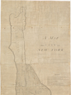
John Randel, Jr. (1787-1865) was an American surveyor, cartographer and civil engineer. He was secretary and chief surveyor for the commission responsible for laying out streets and roads in the City of New York, as appointed by an act of the New York State Legislature on April 3, 1807. Randel surveyed the island of Manhattan and is credited with creating the resulting map, or plan. The survey is considered the foundational master plan of New York City, superimposing a grid of 155 numbered streets and 12 avenues on the topography of the island to mark its future development northward. The manuscript plan, entitled "A Map of the City of New York by the Commissioners appointed by an act of the Legislature passed April 3rd 1807," is dated March 22, 1811 and bears the signatures and seals of the three commissioners, Governeur Morris, Simeon De Witt, and John Rutherfurd, as attested by John Randel, Jr. and Archibald Campbell. It was signed by DeWitt Clinton, Mayor of New York City, on May 4, 1811. The plan is accompanied by the Commissioners' manuscript report containing remarks on the plan, which is similarly signed, dated and attested (13 p., bound). Also present is a New York Public Library scrapbook of correspondence and memoranda relative to the transfer of the plan from the Office of the President of the Borough of Manhattan to the Library, 1935-1936, and its conservation treatment, description and display. It includes a negative photostat of the commissioners' report, as well as two full-size negative photostats of the plan, each mounted on cloth and folded in a pocket portfolio, showing its condition before and after treatment.