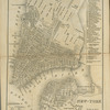
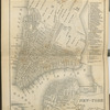
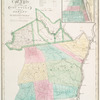
![Atlas of Clinton Co., New York [Title page]"](https://images.nypl.org/index.php?id=1576094&t=b)


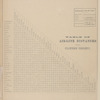


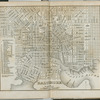
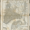
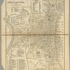
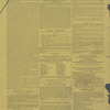
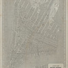
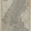
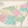
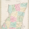
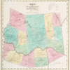
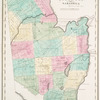
![Sketch of the Early History of Clinton County.[cont.]; Statistics of Clinton County.](https://s3.amazonaws.com/repo-transcoded-web-media-thumnails/4cb83af0-c5f7-012f-530b-58d385a7bc34/4cb83af0-c5f7-012f-530b-58d385a7bc34-00002.jpg)
![Sketch of the Early History of Clinton County.[cont.]; Statistics of Clinton County.](https://images.nypl.org/index.php?id=1576098&t=b)


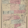
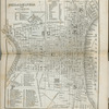
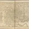
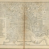
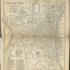
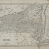
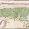
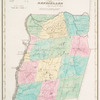
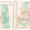
![The Frontiers [Village]; Clinton [Township]; Clinton Mills [Village]; Clinton Subscriber's Business Directory.](https://s3.amazonaws.com/repo-transcoded-web-media-thumnails/4de01aa0-c5f7-012f-d56d-58d385a7bc34/4de01aa0-c5f7-012f-d56d-58d385a7bc34-00002.jpg)


- The Library Shop
- Privacy Policy
- Rules and Regulations
- Using the Internet
- Website Terms and Conditions
- Gifts of Materials to NYPL
-
© The New York Public Library, 2024
The New York Public Library is a 501(c)(3) | EIN 13-1887440
Lionel Pincus and Princess Firyal Map Division, The New York Public Library. "Atlas of Clinton Co., New York : from actual surveys" The New York Public Library Digital Collections. 1869. https://digitalcollections.nypl.org/items/4ae73110-c5f7-012f-594b-58d385a7bc34
Lionel Pincus and Princess Firyal Map Division, The New York Public Library. "Atlas of Clinton Co., New York : from actual surveys" New York Public Library Digital Collections. Accessed April 26, 2024. https://digitalcollections.nypl.org/items/4ae73110-c5f7-012f-594b-58d385a7bc34
Lionel Pincus and Princess Firyal Map Division, The New York Public Library. (1869). Atlas of Clinton Co., New York : from actual surveys Retrieved from https://digitalcollections.nypl.org/items/4ae73110-c5f7-012f-594b-58d385a7bc34
<ref name=NYPL>{{cite web | url=https://digitalcollections.nypl.org/items/4ae73110-c5f7-012f-594b-58d385a7bc34 | title=
(still image)
Atlas of Clinton Co., New York : from actual surveys, (1869)
|author=Digital Collections, The New York Public Library |accessdate=April 26, 2024 |publisher=The New York Public Library, Astor, Lenox, and Tilden Foundations}}</ref>
