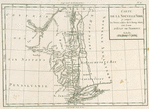


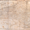
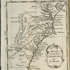
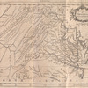
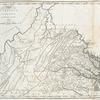
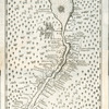
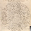
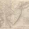
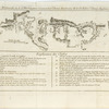
![Carte de la route des lacs depuis Montréal et St. Jean jusqu'à la Riviere d'Hudson : réduite d'après les meilleures cartes anglais e[s], pour servir aux Essais historiques et politiques sur la révolution de l'Amérique septentrionale.](https://images.nypl.org/index.php?id=433629&t=b)
- The Library Shop
- Privacy Policy
- Rules and Regulations
- Using the Internet
- Website Terms and Conditions
- Gifts of Materials to NYPL
-
© The New York Public Library, 2024
The New York Public Library is a 501(c)(3) | EIN 13-1887440
Lawrence H. Slaughter Collection of English maps, charts, globes, books and atlases
Essais historiques et politiques sur les Anglo-Américains, par M. Hilliard d'Auberteuil ...
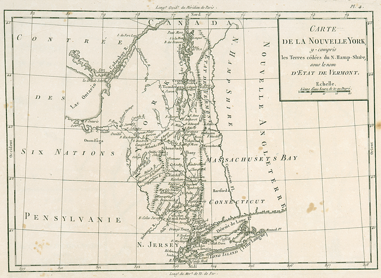
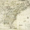
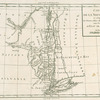
Lionel Pincus and Princess Firyal Map Division, The New York Public Library. "Carte de la Nouvelle York : y-compris les terres cédées du N. Hamp-Shire, sous le nom d'etat de Vermont" The New York Public Library Digital Collections. 1781 - 1782. https://digitalcollections.nypl.org/items/510d47da-f2e8-a3d9-e040-e00a18064a99
Lionel Pincus and Princess Firyal Map Division, The New York Public Library. "Carte de la Nouvelle York : y-compris les terres cédées du N. Hamp-Shire, sous le nom d'etat de Vermont" New York Public Library Digital Collections. Accessed April 23, 2024. https://digitalcollections.nypl.org/items/510d47da-f2e8-a3d9-e040-e00a18064a99
Lionel Pincus and Princess Firyal Map Division, The New York Public Library. (1781 - 1782). Carte de la Nouvelle York : y-compris les terres cédées du N. Hamp-Shire, sous le nom d'etat de Vermont Retrieved from https://digitalcollections.nypl.org/items/510d47da-f2e8-a3d9-e040-e00a18064a99
<ref name=NYPL>{{cite web | url=https://digitalcollections.nypl.org/items/510d47da-f2e8-a3d9-e040-e00a18064a99 | title=
(cartographic)
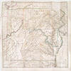
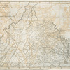
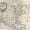
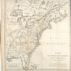
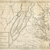
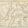
Carte de la Nouvelle York : y-compris les terres cédées du N. Hamp-Shire, sous le nom d'etat de Vermont, (1781 - 1782)
|author=Digital Collections, The New York Public Library |accessdate=April 23, 2024 |publisher=The New York Public Library, Astor, Lenox, and Tilden Foundations}}</ref>