


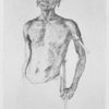
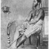
![A typical Duala gentlemen of the olden time [about 1874], Shark Dido, Dido Town, Cameroons, son of the Chief Dido herein referreed to.](https://images.nypl.org/index.php?id=1233673&t=b)
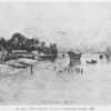
![The Duala shore [Bell Town beach] in 1907.](https://images.nypl.org/index.php?id=1233677&t=b)
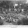
![Native musicians at Tungwa, 1878 [photographed by Grenfell.]](https://images.nypl.org/index.php?id=1233678&t=b)
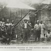
![A group of Congo pioneers at Musuko - Hartland, Crudgington, Comber, Mr.---, a trader, Mr. Greshoff [an agent of the Dutch house], Mrs. Grenfell, and Holman Bentley.](https://images.nypl.org/index.php?id=1233680&t=b)
- The Library Shop
- Privacy Policy
- Rules and Regulations
- Using the Internet
- Website Terms and Conditions
- Gifts of Materials to NYPL
-
© The New York Public Library, 2024
The New York Public Library is a 501(c)(3) | EIN 13-1887440
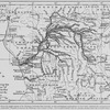
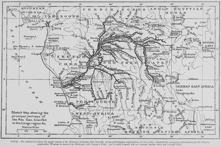
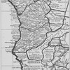
Schomburg Center for Research in Black Culture, Jean Blackwell Hutson Research and Reference Division, The New York Public Library. "Sketch Map showing the principal journeys of the Rev. Geo. Grenfell in the Congo region & co. " The New York Public Library Digital Collections. 1908. https://digitalcollections.nypl.org/items/510d47dd-fc56-a3d9-e040-e00a18064a99
Schomburg Center for Research in Black Culture, Jean Blackwell Hutson Research and Reference Division, The New York Public Library. "Sketch Map showing the principal journeys of the Rev. Geo. Grenfell in the Congo region & co. " New York Public Library Digital Collections. Accessed April 18, 2024. https://digitalcollections.nypl.org/items/510d47dd-fc56-a3d9-e040-e00a18064a99
Schomburg Center for Research in Black Culture, Jean Blackwell Hutson Research and Reference Division, The New York Public Library. (1908). Sketch Map showing the principal journeys of the Rev. Geo. Grenfell in the Congo region & co. Retrieved from https://digitalcollections.nypl.org/items/510d47dd-fc56-a3d9-e040-e00a18064a99
<ref name=NYPL>{{cite web | url=https://digitalcollections.nypl.org/items/510d47dd-fc56-a3d9-e040-e00a18064a99 | title=
(cartographic)
Sketch Map showing the principal journeys of the Rev. Geo. Grenfell in the Congo region & co. , (1908)
|author=Digital Collections, The New York Public Library |accessdate=April 18, 2024 |publisher=The New York Public Library, Astor, Lenox, and Tilden Foundations}}</ref>