![Mirʺ sʺ B[o]gomʺ ch[e]lovĕkū](https://images.nypl.org/index.php?id=58509201&t=b)


- The Library Shop
- Privacy Policy
- Rules and Regulations
- Using the Internet
- Website Terms and Conditions
- Gifts of Materials to NYPL
-
© The New York Public Library, 2024
The New York Public Library is a 501(c)(3) | EIN 13-1887440
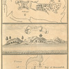
Rare Book Division, The New York Public Library. "A chart of the Western Coast of Africa, from the Straits of Gibraltar to eleven degrees of north latitude; including the Canary & Cape Verde Islands" The New York Public Library Digital Collections. 1745 - 1747. https://digitalcollections.nypl.org/items/510d47df-ff95-a3d9-e040-e00a18064a99
Rare Book Division, The New York Public Library. "A chart of the Western Coast of Africa, from the Straits of Gibraltar to eleven degrees of north latitude; including the Canary & Cape Verde Islands" New York Public Library Digital Collections. Accessed April 19, 2024. https://digitalcollections.nypl.org/items/510d47df-ff95-a3d9-e040-e00a18064a99
Rare Book Division, The New York Public Library. (1745 - 1747). A chart of the Western Coast of Africa, from the Straits of Gibraltar to eleven degrees of north latitude; including the Canary & Cape Verde Islands Retrieved from https://digitalcollections.nypl.org/items/510d47df-ff95-a3d9-e040-e00a18064a99
<ref name=NYPL>{{cite web | url=https://digitalcollections.nypl.org/items/510d47df-ff95-a3d9-e040-e00a18064a99 | title=
(cartographic)
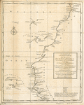
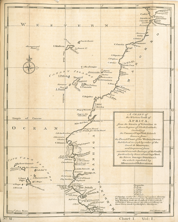
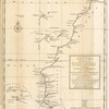
A chart of the Western Coast of Africa, from the Straits of Gibraltar to eleven degrees of north latitude; including the Canary & Cape Verde Islands, (1745 - 1747)
|author=Digital Collections, The New York Public Library |accessdate=April 19, 2024 |publisher=The New York Public Library, Astor, Lenox, and Tilden Foundations}}</ref>