


- The Library Shop
- Privacy Policy
- Rules and Regulations
- Using the Internet
- Website Terms and Conditions
- Gifts of Materials to NYPL
-
© The New York Public Library, 2024
The New York Public Library is a 501(c)(3) | EIN 13-1887440
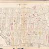
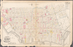
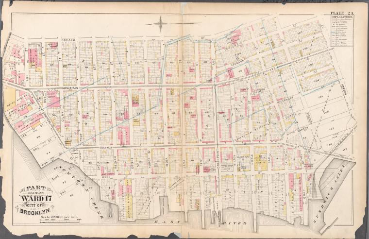
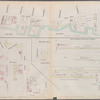
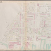
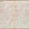
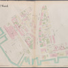
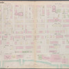
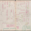
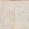
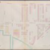
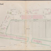
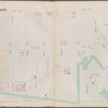
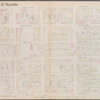
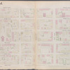
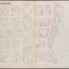
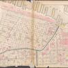
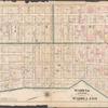
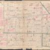
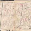
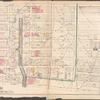
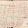
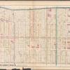
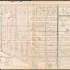
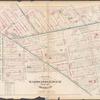
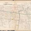
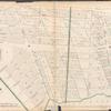
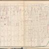
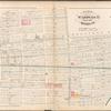
Lionel Pincus and Princess Firyal Map Division, The New York Public Library. "Plate 23: Bounded by Oakland Street, Meserole Street, Eckford Street, Norman Street, 15th Street, (East River) West Street, Commercial Street and Ash Street" The New York Public Library Digital Collections. 1880. https://digitalcollections.nypl.org/items/510d47e2-0b56-a3d9-e040-e00a18064a99
Lionel Pincus and Princess Firyal Map Division, The New York Public Library. "Plate 23: Bounded by Oakland Street, Meserole Street, Eckford Street, Norman Street, 15th Street, (East River) West Street, Commercial Street and Ash Street" New York Public Library Digital Collections. Accessed April 24, 2024. https://digitalcollections.nypl.org/items/510d47e2-0b56-a3d9-e040-e00a18064a99
Lionel Pincus and Princess Firyal Map Division, The New York Public Library. (1880). Plate 23: Bounded by Oakland Street, Meserole Street, Eckford Street, Norman Street, 15th Street, (East River) West Street, Commercial Street and Ash Street Retrieved from https://digitalcollections.nypl.org/items/510d47e2-0b56-a3d9-e040-e00a18064a99
<ref name=NYPL>{{cite web | url=https://digitalcollections.nypl.org/items/510d47e2-0b56-a3d9-e040-e00a18064a99 | title=
(cartographic)
Plate 23: Bounded by Oakland Street, Meserole Street, Eckford Street, Norman Street, 15th Street, (East River) West Street, Commercial Street and Ash Street, (1880)
|author=Digital Collections, The New York Public Library |accessdate=April 24, 2024 |publisher=The New York Public Library, Astor, Lenox, and Tilden Foundations}}</ref>