


![New reservoir. [Order creating commission to obtain land for the reservoir.]](https://images.nypl.org/index.php?id=1648986&t=b)

- The Library Shop
- Privacy Policy
- Rules and Regulations
- Using the Internet
- Website Terms and Conditions
- Gifts of Materials to NYPL
-
© The New York Public Library, 2024
The New York Public Library is a 501(c)(3) | EIN 13-1887440
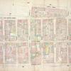
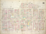
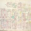
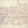
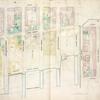
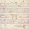
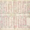
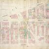
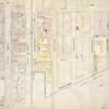
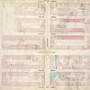
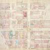
Lionel Pincus and Princess Firyal Map Division, The New York Public Library. "Map bounded by Second Street, Avenue C, Willett Street, Rivington Street, Essex Street; Including East Houston Street, Stanton Street, Avenue A, Norfolk Street, Suffolk Street, Avenue B, Clinton Street, Attorney Street, Ridge Street, Pitt Street" The New York Public Library Digital Collections. 1868. https://digitalcollections.nypl.org/items/5e66b3e8-8384-d471-e040-e00a180654d7
Lionel Pincus and Princess Firyal Map Division, The New York Public Library. "Map bounded by Second Street, Avenue C, Willett Street, Rivington Street, Essex Street; Including East Houston Street, Stanton Street, Avenue A, Norfolk Street, Suffolk Street, Avenue B, Clinton Street, Attorney Street, Ridge Street, Pitt Street" New York Public Library Digital Collections. Accessed April 16, 2024. https://digitalcollections.nypl.org/items/5e66b3e8-8384-d471-e040-e00a180654d7
Lionel Pincus and Princess Firyal Map Division, The New York Public Library. (1868). Map bounded by Second Street, Avenue C, Willett Street, Rivington Street, Essex Street; Including East Houston Street, Stanton Street, Avenue A, Norfolk Street, Suffolk Street, Avenue B, Clinton Street, Attorney Street, Ridge Street, Pitt Street Retrieved from https://digitalcollections.nypl.org/items/5e66b3e8-8384-d471-e040-e00a180654d7
<ref name=NYPL>{{cite web | url=https://digitalcollections.nypl.org/items/5e66b3e8-8384-d471-e040-e00a180654d7 | title=
(cartographic)
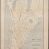
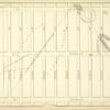
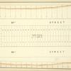
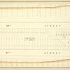
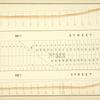
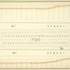
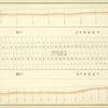
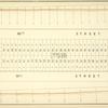
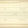
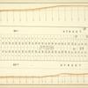
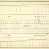
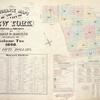
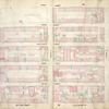
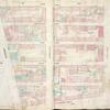
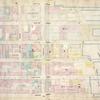
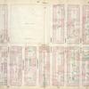
Map bounded by Second Street, Avenue C, Willett Street, Rivington Street, Essex Street; Including East Houston Street, Stanton Street, Avenue A, Norfolk Street, Suffolk Street, Avenue B, Clinton Street, Attorney Street, Ridge Street, Pitt Street, (1868)
|author=Digital Collections, The New York Public Library |accessdate=April 16, 2024 |publisher=The New York Public Library, Astor, Lenox, and Tilden Foundations}}</ref>