
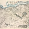

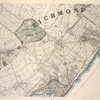


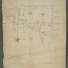
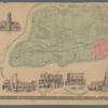
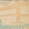
![Map of New Brighton, Staten Island [cartographic material] : 1st, 2nd and 3rd wards.](https://images.nypl.org/index.php?id=4030805&t=b)

- The Library Shop
- Privacy Policy
- Rules and Regulations
- Using the Internet
- Website Terms and Conditions
- Gifts of Materials to NYPL
-
© The New York Public Library, 2024
The New York Public Library is a 501(c)(3) | EIN 13-1887440
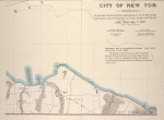
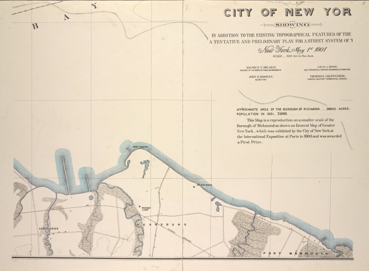
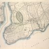
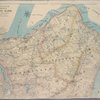
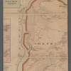
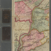
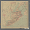
Lionel Pincus and Princess Firyal Map Division, The New York Public Library. "General map of the borough of Richmond (Staten Island) in the city of New York : showing in addition to the existing topographical features of the borough a tentative and preliminary plan for a street system of the same." The New York Public Library Digital Collections. 1901. https://digitalcollections.nypl.org/items/5e66b3e8-9cbc-d471-e040-e00a180654d7
Lionel Pincus and Princess Firyal Map Division, The New York Public Library. "General map of the borough of Richmond (Staten Island) in the city of New York : showing in addition to the existing topographical features of the borough a tentative and preliminary plan for a street system of the same." New York Public Library Digital Collections. Accessed April 23, 2024. https://digitalcollections.nypl.org/items/5e66b3e8-9cbc-d471-e040-e00a180654d7
Lionel Pincus and Princess Firyal Map Division, The New York Public Library. (1901). General map of the borough of Richmond (Staten Island) in the city of New York : showing in addition to the existing topographical features of the borough a tentative and preliminary plan for a street system of the same. Retrieved from https://digitalcollections.nypl.org/items/5e66b3e8-9cbc-d471-e040-e00a180654d7
<ref name=NYPL>{{cite web | url=https://digitalcollections.nypl.org/items/5e66b3e8-9cbc-d471-e040-e00a180654d7 | title=
(cartographic)
General map of the borough of Richmond (Staten Island) in the city of New York : showing in addition to the existing topographical features of the borough a tentative and preliminary plan for a street system of the same., (1901)
|author=Digital Collections, The New York Public Library |accessdate=April 23, 2024 |publisher=The New York Public Library, Astor, Lenox, and Tilden Foundations}}</ref>