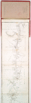
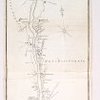
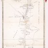
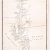
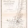
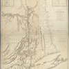
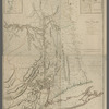
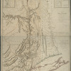
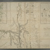
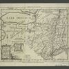
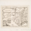
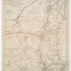
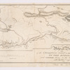
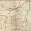
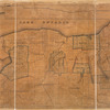
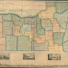
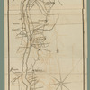
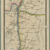
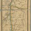
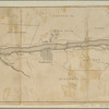
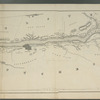
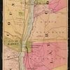
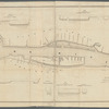
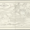
An improved map of the Hudson River : with the post roads between N. York & Albany

More Details Cite This Item

View this item elsewhere:

Title
An improved map of the Hudson River : with the post roads between N. York & Albany
Names
Harper & Brothers (Publisher)
Chapin, William, 1802-1888 (Engraver)
Collection

Maps of New York City and State

Parts

Hudson River

Dates / Origin
Date Issued: 1834
Place: [New York]
Publisher: Published by Harper & Brs.
Library locations
Lionel Pincus and Princess Firyal Map Division
Shelf locator: Map Div. 00-483
Topics
New York (N.Y.)
New Jersey
Hudson River (N.Y. and N.J.) -- Maps, Tourist
Hudson River Valley (N.Y. and N.J.) -- Maps, Tourist
Genres
Maps
Notes
Content: NYPL copy includes initials inscribed in ink in lower right margin.
Citation/reference: Variant of Phillips. Maps of America, 325
Content: National Endowment for the Humanities Grant for Access to Early Maps of the Middle Atlantic Seaboard.
Content: Relief shown by hachures and spot heights.
Statement of responsibility: drawn & engraved expressly for the tourist [by] W. Chapin, sc.
Physical Description
Extent: 1 map ; 104 x 14 cm. folded in cover 15 x 9 cm.
Type of Resource
Cartographic
Identifiers
RLIN/OCLC: 45693936
NYPL catalog ID (B-number): b14951933
Universal Unique Identifier (UUID): 50edf4b0-c5aa-012f-33b4-58d385a7bc34
Rights Statement
The New York Public Library believes that this item is in the public domain under the laws of the United States, but did not make a determination as to its copyright status under the copyright laws of other countries. This item may not be in the public domain under the laws of other countries. Though not required, if you want to credit us as the source, please use the following statement, "From The New York Public Library," and provide a link back to the item on our Digital Collections site. Doing so helps us track how our collection is used and helps justify freely releasing even more content in the future.

Item timeline of events

  • 1834: Issued
  • 2015: Digitized
  • 2024: Found by you!
  • 2025

MLA Format

Lionel Pincus and Princess Firyal Map Division, The New York Public Library. "An improved map of the Hudson River : with the post roads between N. York & Albany" The New York Public Library Digital Collections. 1834. https://digitalcollections.nypl.org/items/8bd31a8f-cfe8-3cb6-e040-e00a18061cd0

Chicago/Turabian Format

Lionel Pincus and Princess Firyal Map Division, The New York Public Library. "An improved map of the Hudson River : with the post roads between N. York & Albany" New York Public Library Digital Collections. Accessed April 25, 2024. https://digitalcollections.nypl.org/items/8bd31a8f-cfe8-3cb6-e040-e00a18061cd0

APA Format

Lionel Pincus and Princess Firyal Map Division, The New York Public Library. (1834). An improved map of the Hudson River : with the post roads between N. York & Albany Retrieved from https://digitalcollections.nypl.org/items/8bd31a8f-cfe8-3cb6-e040-e00a18061cd0

Wikipedia Citation

<ref name=NYPL>{{cite web | url=https://digitalcollections.nypl.org/items/8bd31a8f-cfe8-3cb6-e040-e00a18061cd0 | title= (cartographic) 
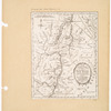
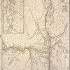
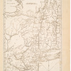
An improved map of the Hudson River : with the post roads between N. York & Albany, (1834) |author=Digital Collections, The New York Public Library |accessdate=April 25, 2024 |publisher=The New York Public Library, Astor, Lenox, and Tilden Foundations}}</ref>

An improved map of the Hudson River : with the post roads between N. York & Albany