


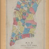
![Central Park : memorial of the Common Council of the City of New York to the Legislature, approved June 11th, 1853...[title page]](https://images.nypl.org/index.php?id=5190254&t=b)


- The Library Shop
- Privacy Policy
- Rules and Regulations
- Using the Internet
- Website Terms and Conditions
- Gifts of Materials to NYPL
-
© The New York Public Library, 2024
The New York Public Library is a 501(c)(3) | EIN 13-1887440
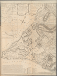
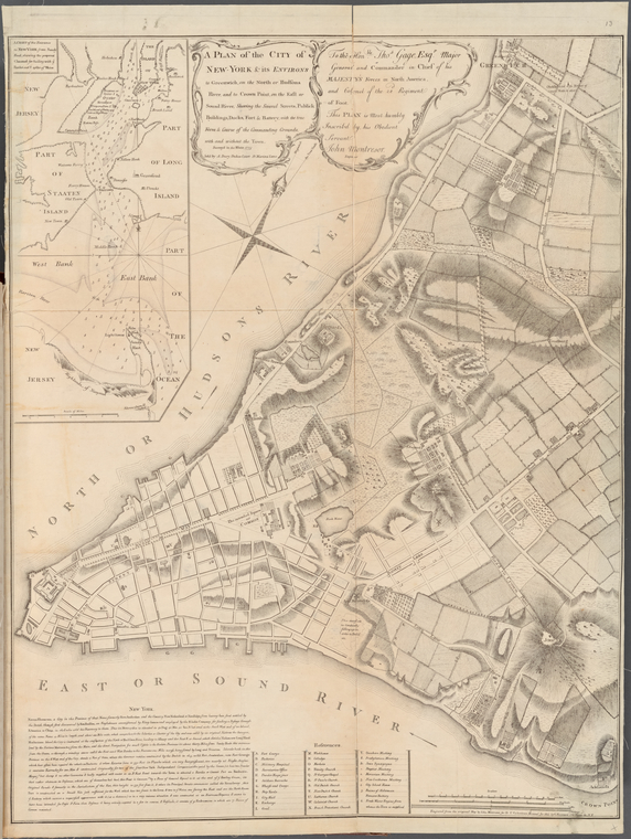
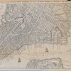
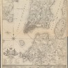
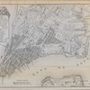
Lionel Pincus and Princess Firyal Map Division, The New York Public Library. "A Plan of the City of New-York & its Environs to Greenwich, on the North or Hudsons River, and to Crown Point, on the East or Sound River, Shewing the Several Streets, Publick Buildings, Docks, Fort & Battery with the true Form & Course of the Commanding Grounds, with and without the Town. Surveyed in the Winter, 1775." The New York Public Library Digital Collections. 1775 - 1855. https://digitalcollections.nypl.org/items/ec2f24f0-0f6a-0132-7a88-58d385a7b928
Lionel Pincus and Princess Firyal Map Division, The New York Public Library. "A Plan of the City of New-York & its Environs to Greenwich, on the North or Hudsons River, and to Crown Point, on the East or Sound River, Shewing the Several Streets, Publick Buildings, Docks, Fort & Battery with the true Form & Course of the Commanding Grounds, with and without the Town. Surveyed in the Winter, 1775." New York Public Library Digital Collections. Accessed April 25, 2024. https://digitalcollections.nypl.org/items/ec2f24f0-0f6a-0132-7a88-58d385a7b928
Lionel Pincus and Princess Firyal Map Division, The New York Public Library. (1775 - 1855). A Plan of the City of New-York & its Environs to Greenwich, on the North or Hudsons River, and to Crown Point, on the East or Sound River, Shewing the Several Streets, Publick Buildings, Docks, Fort & Battery with the true Form & Course of the Commanding Grounds, with and without the Town. Surveyed in the Winter, 1775. Retrieved from https://digitalcollections.nypl.org/items/ec2f24f0-0f6a-0132-7a88-58d385a7b928
<ref name=NYPL>{{cite web | url=https://digitalcollections.nypl.org/items/ec2f24f0-0f6a-0132-7a88-58d385a7b928 | title=
(cartographic)
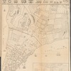
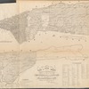
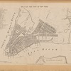
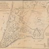
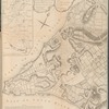
A Plan of the City of New-York & its Environs to Greenwich, on the North or Hudsons River, and to Crown Point, on the East or Sound River, Shewing the Several Streets, Publick Buildings, Docks, Fort & Battery with the true Form & Course of the Commanding Grounds, with and without the Town. Surveyed in the Winter, 1775., (1775 - 1855)|author=Digital Collections, The New York Public Library |accessdate=April 25, 2024 |publisher=The New York Public Library, Astor, Lenox, and Tilden Foundations}}</ref>