Click to visit the main New York Public Library Homepage
The New York Public Library
Digital Collections
About Digital Collections
Browse
Search only public domain materials
Items
Collections
Divisions
Home
Search
Browse
About
Search only public domain materials
Items
Collections
Divisions
Digital Collections
Using Images
Using Data
Search
Keyword search
Show filters
Hide filters
Show Only Public Domain
topic
Real property
1855
Business enterprises
467
Description and travel
165
History
93
Geography
63
More
Less
name
Beers, F. W. (Frederick W.)
492
Everts, Ensign & Everts
231
Hyde, E. Belcher
175
Beers, D. G. (Daniel G.)
172
F.W. Beers & Co
168
More
Less
collection
Atlases of the United States
2944
Atlases of New York City
175
Maps of North America
73
Lawrence H. Slaughter Collection of English maps, charts, globes, books and atlases
71
Atlases, gazetteers, guidebooks and other books
23
More
Less
place
New York (State)
1902
Westchester County (N.Y.)
223
Erie County (N.Y.)
197
New Jersey
187
Suffolk County (N.Y.)
181
More
Less
genre
Maps
3100
Atlases
2936
Prints
72
Surveys
54
Plans
44
More
Less
publisher
F. W. Beers & Co
148
E. Belcher Hyde
119
E. Belcher-Hyde
112
Century Map Company
111
Everts, Ensign & Everts
99
More
Less
division
Map Division
3275
Milstein Division
29
Rare Book Division
1
type
cartographic
3163
text
188
still image
13
Date Range
to
Looking for this collection?
Atlases of the United States
3,868 items
3,305 results found for:
county atlas
Sort by:
Relevance
Title
Date created
Date digitized
Sequence
Results 451 - 500
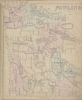
Pawling [Township]
collection:
Atlases
of the United States
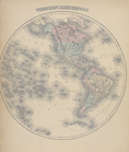
Western Hemisphere
collection:
Atlases
of the United States
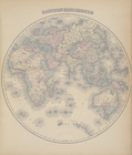
Eastern Hemisphere
collection:
Atlases
of the United States
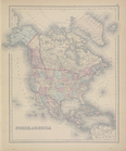
North America
collection:
Atlases
of the United States
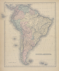
South America
collection:
Atlases
of the United States
General Description - Europe.
collection:
Atlases
of the United States
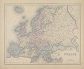
Europe
collection:
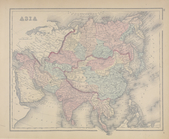
Atlases
of the United States
Asia
collection:
Atlases
of the United States
m
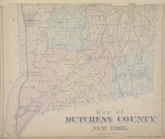
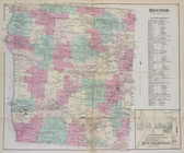
Map of Dutchess
County
New York
collection:
Atlases
of the United States
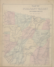
Map of Pleasant Valley Dutchess
County
collection:
Atlases
of the United States
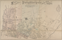
Map of the city of Poughkeepsie Dutchess
County
collection:
Atlases
of the United States
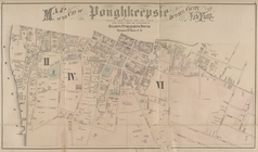
Map of the city of Poughkeepsie Dutchess
County
collection:
Atlases
of the United States
Catharine Business Notices; O…
collection:
Atlases
of the United States
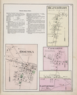
Hector [Township]; Town of He…
collection:
Atlases
of the United States
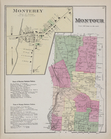
Monterey [Village]; Montour […
collection:
Atlases
of the United States
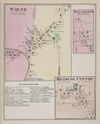
Wayne [Village]; Irelandville…
collection:
Atlases
of the United States
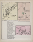
Tyrone [Village]; Altay [Vill…
collection:
Atlases
of the United States
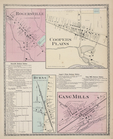
Rogersville [Village]; Cooper…
collection:
Atlases
of the United States
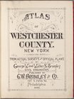
Atlas
of Westchester
County
. New York
collection:
Atlases
of the United States
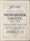
Atlas
of Westchester
County
. New York
collection:
Atlases
of the United States
The new century
atlas
of Cayuga
County
collection:
Atlases
of the United States
Essex
County
, V. 3, Double Page Plate No. 8
note:
v. 3.
Atlas
of Essex
County
... by Ellis
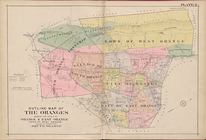
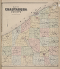
Map of Chautauqua
County
collection:
Atlases
of the United States
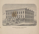
Brewer Block, Westfield, Chautauqua
County
collection:
Atlases
of the United States
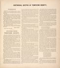
Historical Sketch of Tompkins
County
collection:
Atlases
of the United States
Historical Sketch of Tompkins
County
[cont.]
collection:
Atlases
of the United States
Historical Sketch of Tompkins
County
[cont.]
collection:
Atlases
of the United States
Historical Sketch of Tompkins
County
[cont.]
collection:
Atlases
of the United States
Historical Sketch of Tompkins
County
[cont.]
collection:
Atlases
of the United States
Historical Sketch of Tompkins
County
[cont.]
collection:
Atlases
of the United States
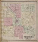
Tompkins
County
collection:
Atlases
of the United States
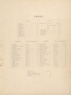
Index
collection:
Atlases
of the United States
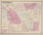
Austerlitz [Township]
collection:
Atlases
of the United States
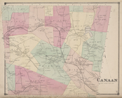
Canaan [Township]
collection:
Atlases
of the United States
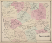
Claverack [Township]
collection:
Atlases
of the United States
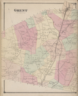
Ghent [Township]
collection:
Atlases
of the United States
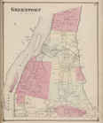
Greenport [Township]
collection:
Atlases
of the United States
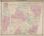
Hillsdale [Township]
collection:
Atlases
of the United States
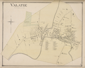
Valatie [Village]
collection:
Atlases
of the United States
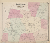
Taghkanic [Township]
collection:
Atlases
of the United States
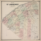
Map of St. Lawrence
County
.
collection:
Atlases
of the United States
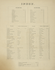
Index.
collection:
Atlases
of the United States
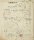
Amherst [Township]
collection:
Atlases
of the United States
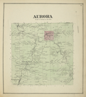
Aurora [Township]
collection:
Atlases
of the United States
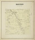
Boston [Township]
collection:
Atlases
of the United States
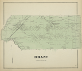
Brant [Township]
collection:
Atlases
of the United States
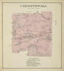
Cheektowaga [Township]
collection:
Atlases
of the United States
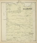
Clarence [Township]
collection:
Atlases
of the United States
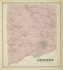
Concord [Township]
collection:
Atlases
of the United States
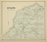
Evans [Township]
collection:
Atlases
of the United States
1
2
…
5
6
7
8
9
10
11
12
13
14
Previous
Next
1
2
…
5
6
7
8
9
10
11
12
13
14
Previous
Next