Click to visit the main New York Public Library Homepage
The New York Public Library
Digital Collections
About Digital Collections
Browse
Search only public domain materials
Items
Collections
Divisions
Home
Search
Browse
About
Search only public domain materials
Items
Collections
Divisions
Digital Collections
Using Images
Using Data
Search
Keyword search
Show filters
Hide filters
Show Only Public Domain
topic
Exhibitions
151
Real property
81
Landowners
68
History
39
Maps
34
More
Less
name
New York World's Fair (1939-1940 : New York, N.Y.)
151
Nicolaus Germanus, active 15th century
27
Ptolemy, 2nd cent
27
Dati, Gregorio, 1362-1436
26
Grand Central Terminal (New York, N.Y.)
17
More
Less
collection
Bancker plans
950
Maps of North America
154
New York World's Fair 1939 and 1940 Incorporated records
151
Maps of New York City and State
115
Renaissance and medieval manuscripts collection
75
More
Less
place
New York (State)
260
New York
208
New York (N.Y.)
74
Manhattan (New York, N.Y.)
47
Africa
42
More
Less
genre
Maps
1469
Surveys
974
land surveys
835
Manuscript maps
151
Documents
141
More
Less
publisher
Wolfgang, Waesberge, Boom & van Someren
42
producer not identified
30
publisher not identified
28
U.S. Light-House Board
14
Producer not identified
8
More
Less
division
Manuscripts and Archives Division
1281
Map Division
295
Schomburg Manuscripts, Archives and Rare Books Division
110
Spencer Collection
20
Berg Collection
8
More
Less
type
cartographic
1463
still image
303
text
286
Date Range
to
Looking for this collection?
Bancker plans
1,080 items
1,734 results found for:
Maps, Manuscript
Sort by:
Relevance
Title
Date created
Date digitized
Sequence
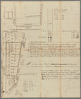
1. Plan de L'Isle St. louis, …
10c red brown
Map
of Louisiana Purchase block
m
1750-1753
m
1792 October
m
1792 October
m
1793 August 14
m
1793 August 14
m
1793 March 10
m
1793 March 18
m
1800 October 29
m
1800 October 29
m
1800 October 29
m
1801 December 21
m
1801 December 21
m
1803 April 6
m
1803 April, June 1803
m
1810 January 7
m
1810 January 8
m
1900 census enumeration distr…
abstract:
Base
map
photocopy that was annotated with
manuscript
m
1905 Library
map
of Manhattan, City of New York
abstract:
A black and white
Map
of Manhattan, City
m
1906 Library
map
of Manhattan, City of New York
note:
A black and white
Map
of Manhattan, City
m
1907 Library
map
of Manhattan, City of New York
note:
A black and white
Map
of Manhattan, City
m
1907 Library
map
of Manhattan, City of New York
abstract:
A black and white
Map
of Manhattan, City
m
27th assembly district
collection:
Maps
of New York City and State
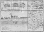
[A burial.]
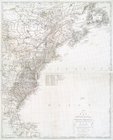
A chart of Delaware Bay and R…
note:
Copy in
Map
Div. 00-498: Emmet Collection.
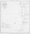
A Chart of the islands of Ane…
A chorographical
map
of the Province
note:
Only part of the whole
map
m
A correct
map
of the state of Vermont, from
note:
…
manuscript
note in ink
A description of the Towne of…
topic:
Maps
,
Manuscript
A general sketch of the coast…
A general sketch of the Harbo…
collection:
…
map
(from lat. 5⁰ 30
[A group of men bowed down pa…
[A group of people wearing or…
A
map
of that part of Pensylvania now the principal
note:
… to Early
Maps
of the Middle
A
map
of the country from Rariton River
note:
… to Early
Maps
of the Middle
A
map
of the south part of the lands
A
Map
of the United States of America, 1830
note:
… to Early
Maps
of the Middle
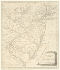
A new and accurate
map
of New Jersey
note:
LC
Maps
of North America, 1750-1789, 1242
A New and accurate
map
of the present
note:
… with a new and accurate
map
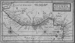
A New and Exact
Map
of Guinea Divided
A New chart of Delaware Bay :…
note:
… to Early
Maps
of the Middle
m
… with and improved from
manuscripts
note:
… in this
map
."…
A new
map
of the city of New York
note:
NYPL copy annotated with
manuscript
marks on verso
A new
map
of the province of Maryland
note:
Copy in
Map
Div. 00-459: Emmet 6046.
A new
map
of Virginia
note:
… to Early
Maps
of the Middle
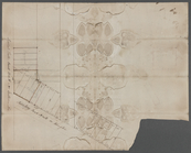
A new plan of ye great town o…
note:
… in
manuscript
. Here
m
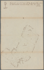
A plan of 8 acres land survey…
note:
Mapping
the Nation (NEH grant, 2015-2018)…
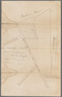
A plan of Fort Montgomery & F…
note:
…
map
overlapping main
map
: Part of Hudsons
A plan of New York Island, wi…
note:
… to Early
Maps
of the Middle
1
2
3
4
5
6
7
Previous
Next
1
2
3
4
5
6
7
Previous
Next