Click to visit the main New York Public Library Homepage
The New York Public Library
Digital Collections
About Digital Collections
Browse
Search only public domain materials
Items
Collections
Divisions
Home
Search
Browse
About
Search only public domain materials
Items
Collections
Divisions
Digital Collections
Using Images
Using Data
Search
Keyword search
Show filters
Hide filters
Show Only Public Domain
topic
Real property
101
Geography
79
Landowners
63
Administrative and political divisions
62
Railroads
58
More
Less
name
Burr, David H., 1803-1875
176
Moll, Herman, -1732
86
Rawdon, Clark & Co
79
Rawdon, Wright & Co
79
De Witt, Simeon, 1756-1834
58
More
Less
collection
Maps of North America
392
Lawrence H. Slaughter Collection of English maps, charts, globes, books and atlases
344
Maps of New York City and State
259
Atlases of the United States
187
John H. Levine Collection
26
More
Less
place
New York (State)
308
United States
254
New York (N.Y.)
245
Middle Atlantic States
149
Maps
130
More
Less
genre
Maps
1225
Atlases
159
Prints
7
Title pages
4
Early works to 1800
3
More
Less
publisher
For sale by the principal booksellers
67
Printed for Timothy Childe at the White Hart at the West-end of St. Paul's Church-yard
47
s.n
45
s.n.,
34
... Sold ... by Tho. Bowles, print and map-seller in St. Paul's-Churchyard
32
More
Less
division
Map Division
1220
Wallach Division: Print Collection
7
Rare Book Division
1
type
cartographic
1215
text
20
still image
9
Date Range
to
1,230 results found for:
Middle Atlantic States
Sort by:
Relevance
Title
Date created
Date digitized
Sequence
… with the
Atlantic
…
Map of the
middle
states
of America
note:
… to Early Maps of the
Middle
Atlantic
Seaboard.
Middle
States
: Maryland & Virginia.
note:
… of the
state
of Connecticut."…
A new chart of the coast of N…
note:
… to Early Maps of the
Middle
Atlantic
Seaboard.
… through the
middle
& northern
states
note:
… the
Atlantic
Ocean to Virginia
Map showing route of the New …
collection:
Maps of New York City and
State
Pas caerte van Nieu Nederland…
Profiles of the canals and ra…
collection:
United
States
(except New York)…
A chorographical map of the c…
note:
… to Early Maps of the
Middle
Atlantic
Seaboard.
Road from Philadela. to New Y…
note:
… to Early Maps of the
Middle
Atlantic
Seaboard.
Road from Philadela. to New Y…
note:
… to Early Maps of the
Middle
Atlantic
Seaboard.
Road from Philadelphia to New…
note:
… to Early Maps of the
Middle
Atlantic
Seaboard.
Road from Philadelphia to New…
note:
… to Early Maps of the
Middle
Atlantic
Seaboard.
Road from Philadelphia to New…
note:
… to Early Maps of the
Middle
Atlantic
Seaboard.
Road from Philadelphia to New…
note:
… to Early Maps of the
Middle
Atlantic
Seaboard.
Road from Philada. to New Yor…
note:
… to Early Maps of the
Middle
Atlantic
Seaboard.
Road from Philadelphia to Was…
note:
… to Early Maps of the
Middle
Atlantic
Seaboard.
Road from Philadela. to Washi…
note:
… to Early Maps of the
Middle
Atlantic
Seaboard.
Road from Philadela. to Washi…
note:
… to Early Maps of the
Middle
Atlantic
Seaboard.
Road from Philadela. to Washi…
note:
… to Early Maps of the
Middle
Atlantic
Seaboard.
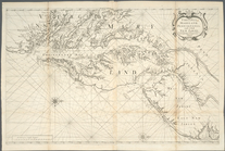
Virginia, Maryland, Pennsilva…
note:
Distinguished from later
states
by northern
A map of that part of America…
note:
… to Early Maps of the
Middle
Atlantic
Seaboard.
Virginia, Maryland, Pennsilva…
Pas caarte van Nieu Nederlandt
note:
… to Early Maps of the
Middle
Atlantic
Seaboard.
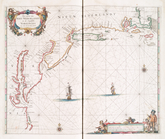
Sketch B: showing the progres…
collection:
States
A chart of the Atlantick Ocea…
Map of the Clinton County Coa…
abstract:
Covers large parts of
states
of Pennsylvania
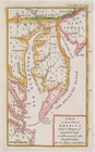
Nova Belgica et Anglia Nova.
note:
Covers New England and the
Middle
Atlantic
states
Nova Belgica et Anglia Nova.
note:
Covers New England and the
Middle
Atlantic
states
… through the
middle
& northern
states
note:
… the Northern and
Middle
States
An exact map of New Jersey, P…
note:
Shows the
Middle
Atlantic
states
, including
Nova Belgica et Anglia Nova.
note:
Covers New England and the
Middle
Atlantic
states
m
The north eastern coast of No…
note:
…, of the
stat[e
] of New York."…
From New York (1) to Stratford
collection:
…
States
of America
Washington city
note:
… to Early Maps of the
Middle
Atlantic
Seaboard.
Nova Belgica et Anglia Nova.
note:
Covers New England and the
Middle
Atlantic
states
Nova Belgica et Anglia Nova.
note:
Covers New England and the
Middle
Atlantic
states
Map showing the Southern Mary…
collection:
States
Map of the
state
of Virginia …
Philadelphia and the commence…
note:
… to Early Maps of the
Middle
Atlantic
Seaboard.
Nova Belgica et Anglia Nova.
note:
Covers New England and the
Middle
Atlantic
states
The coast of the United
States
of North
note:
…, of the
state
of New York."…
Côte de York-town à Boston : …
note:
… to Early Maps of the
Middle
Atlantic
Seaboard.
Nova Belgica et Anglia Nova.
Road from Philadela. to New Y…
note:
… to Early Maps of the
Middle
Atlantic
Seaboard.
Pas kaart van de zee kusten v…
note:
… of the
Middle
Atlantic
Seaboard.
m
The Wyoming Coal Field and it…
collection:
States
Road from Philadelphia to Was…
note:
… to Early Maps of the
Middle
Atlantic
Seaboard.
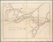
Map shewing the location of t…
note:
by Van R. Richmond,
State
Engr. & Surv.
A new map of part of the United
States
of North
note:
… to Early Maps of the
Middle
Atlantic
Seaboard
1
2
3
4
5
Previous
Next
1
2
3
4
5
Previous
Next