Click to visit the main New York Public Library Homepage
The New York Public Library
Digital Collections
About Digital Collections
Browse
Search only public domain materials
Items
Collections
Divisions
Home
Search
Browse
About
Search only public domain materials
Items
Collections
Divisions
Digital Collections
Using Images
Using Data
Search
Filtered search
Show filters
Hide filters
Show Only Public Domain
topic
Real property
392
Business enterprises
180
Administrative and political divisions
68
Railroads
65
Fire insurance
53
More
Less
name
Beers, F. W. (Frederick W.)
172
Beers, S. N
133
Stone & Stewart
129
Beers, D. G. (Daniel G.)
88
Prindle, A. B
48
More
Less
collection
Atlases of the United States
475
Maps of North America
167
Atlases of New York City
142
Maps of New York City and State
94
Pamiatniki stariny v zapadnykh guberniakh imperii
9
More
Less
place
New York (State)
393
New York Metropolitan Area
56
Brooklyn (New York, N.Y.)
55
Westchester County (N.Y.)
50
Erie County (N.Y.)
49
More
Less
genre
Maps
884
Atlases
475
Prints
32
Cadastral maps
31
Illustrations
13
More
Less
publisher
Stone & Stewart
86
F. W. Beers, A. D. Ellis & others
48
Beers, Ellis & Soule
46
C. K. Stone
40
I.B. Culver & Co
32
More
Less
division
Map Division
878
Rare Book Division
14
General Research Division
8
Manuscripts and Archives Division
2
Schomburg Manuscripts, Archives and Rare Books Division
2
More
Less
type
x
cartographic
text
16
still image
11
Date Range
to
905 results found
Filtering on:
x
Date
: 1865 - 1869
x
Type
: cartographic
Sort by:
Title
Date created
Date digitized
Sequence
Map of Camp Chase. Drawn on a…
Saratoga Springs [Township]
Schuylerville Business Direct…
Saratoga [Township]
Stillwater [Township]
References; Waterford [Villag…
Waterford [Township]
Beechers Hollow [Village]; Be…
Wilton [Township]
Map of Saratoga County
Residence of James Carrigan, …
Ballston [Township]
Ballston Spa Business Directo…
Charlton [Township]
Grangerville [Village]; Grang…
Clifton Park [Township]
Corinth [Township]; Palmer Fa…
Clifton Park [Village]; Clift…
Day Corners Business Director…
Edinburgh [Township]
Crescent [Village]; Crescent …
Galway [Township]; Yorks Corn…
Greenfield [Township]; Pages …
Bloodville [Village]; Bloodvi…
Hadley [Township]; Hadley Bus…
Half Moon [Township]
Factory Village [Village]; Fa…
Malta [Township]
Burnt Hills [Village]; Burnt …
Milton [Township]
Moreau [Township]
Conklingville [Village]; Conk…
Northumberland [Township]
Providence [Township]; Hagedo…
References; Saratoga Springs …
The Jeannette ; Lost In the I…
Chart of Smith Sound Showing …
Map showing North Pole, [Map]
Port Foulke and Vicinity Nort…
Map of the country thirty thr…
Map of New York and vicinity …
Map of the country thirty thr…
New-York and vicinity as prop…
Map of the County of New York…
m
Sanitary & topographical map …
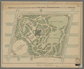
Design for laying out the gro…
Map of the county of Kings, s…
Watson's new map of the city …
New York and environs : desig…
New York and environs : desig…
1
2
3
4
Previous
Next
1
2
3
4
Previous
Next