Click to visit the main New York Public Library Homepage
The New York Public Library
Digital Collections
About Digital Collections
Browse
Search only public domain materials
Items
Collections
Divisions
Home
Search
Browse
About
Search only public domain materials
Items
Collections
Divisions
Digital Collections
Using Images
Using Data
Search
Filtered search
Show filters
Hide filters
Show Only Public Domain
topic
Real property
48
Railroads
16
Administrative and political divisions
13
Parks
6
Canals
5
More
Less
name
E. Robinson Co
47
Pidgeon, R. H. (Roger H.)
47
G.M. Hopkins & Co
24
Julius Bien & Co
3
Rand McNally and Company
3
More
Less
collection
Atlases of the United States
71
Maps of North America
38
Maps of New York City and State
16
Picturesque Palestine, Sinai and Egypt
2
Century Company records
1
More
Less
place
Essex County
47
Essex County (N.J.)
47
New Jersey
47
Troy (N.Y.)
24
New York (State)
15
More
Less
genre
Maps
127
Atlases
71
Illustrations
3
Prints
3
Designs and plans
2
More
Less
publisher
E. Robinson
47
The Company
24
S. Augustus Mitchell
3
Board of Railroad Commissioners
2
D. Appleton
2
More
Less
division
Map Division
125
Dorot Jewish Division
2
Manuscripts and Archives Division
1
Rare Book Division
1
type
x
cartographic
still image
2
text
2
Date Range
to
129 results found
Filtering on:
x
Date
: 1881 - 1881
x
Type
: cartographic
Sort by:
Title
Date created
Date digitized
Sequence
Kosmografiia.
Map of New England with adjac…
m
Reid, Harry Fielding
Transportation lines tributar…
City of Baltimore
This plan of the city of Phil…
Map of the White Mountains of…
Montana Territory
m
Dakota Territory
City of Philadelphia
Map of the South West
Map of the city of Cleveland,…
Rand, McNally & Co.'s Kansas
m
Profile of grades of the Iowa…
Railroad map of Iowa
Michigan
Map of the State of Indiana :…
Battle of Long Island
Yellowstone National Park, Bi…
Map of the states of Californ…
Post route map of the states …
County and township map of Ut…
Topographical & township map …
Map of the United States defi…
County map of the state of Te…
m
A new and accurat[e] detail m…
Map showing the boulevards an…
Eastern United States, No. 6
Eastern United States, No. 5
Map showing the Southern Mary…
County map of the states of G…
Atlantic and Gulf Coast Canal…
Map of Alabama
New map of Boston from latest…
General plan for sanitary imp…
Plan of proposed Muddy River …
General geologic map of the a…
m
Map of Cook's tours in America
Driving road chart of Westche…
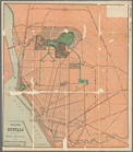
Olmsted's sketch map of Buffa…
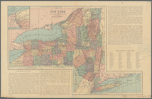
[Map of] New York [State]: [S…
Map of the Adirondack wildern…
Profiles of the New York Stat…
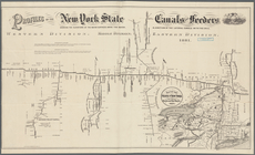
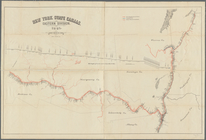
New York State canals: Easter…
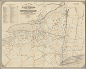
Map of the rail roads and can…
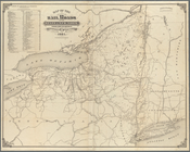
Map of the rail roads of the …
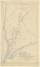
Map of water shed of Housaton…
m
Map of Linn County, Iowa: [dr…
m
Transportation lines tributar…
Plan of High Bridge Park : pr…