Click to visit the main New York Public Library Homepage
The New York Public Library
Digital Collections
About Digital Collections
Browse
Search only public domain materials
Items
Collections
Divisions
Home
Search
Browse
About
Search only public domain materials
Items
Collections
Divisions
Digital Collections
Using Images
Using Data
Search
Filtered keyword search
Show filters
Hide filters
Show Only Public Domain
topic
Discovery and exploration
9
Geology
3
Historical geography
3
New York (State)
3
Administrative and political divisions
2
More
Less
name
x
Geological Survey (U.S.)
Walcott, Charles D. (Charles Doolittle), 1850-1927
21
Gannett, Henry, 1846-1914
17
United States. Congress (55th, 3rd session : 1898-1899)
10
U.S. Coast and Geodetic Survey
9
More
Less
collection
Maps of North America
50
Maps of New York City and State
9
place
Alaska
12
United States
6
New York (State)
5
Chugach Mountains (Alaska)
3
Colorado
3
More
Less
genre
Maps
59
Topographic maps
39
Geological maps
3
Physical maps
2
Diagrams
1
publisher
U.S. Geological Survey
29
U.S. Congress
10
Norris Peters Co
3
The Survey
3
Appalachian Mountain Club
2
More
Less
division
x
Map Division
type
cartographic
59
still image
1
Date Range
to
59 results found for:
x
Reliefs
Filtering on:
x
Division
: Map Division
x
Name
: Geological Survey (U.S.)
Sort by:
Relevance
Title
Date created
Date digitized
Sequence
United States
relief
map
note:
Relief
shown by contours and gradient tints.
United States
relief
map
note:
Relief
shown by hypsometric tints and contours.
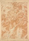
Relief
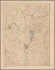
map of New York and vicinity
note:
Relief
shown by shading.
Staten Island, N.Y., ed. of F…
note:
Relief
shown by contours and spot heights.
Santanoni, ed. of Mar. 1904, …
note:
Relief
shown by contours and spot heights.
Mt. Marcy, ed. of June 1902, …
note:
Relief
shown by contours and spot heights.
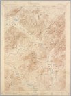
m
New York City and vicinity
note:
Relief
shown by contours and spot heights.
United States contour map
note:
Relief
shown by contours.
United States contour map
note:
Relief
shown by contours.
m
United States
note:
Relief
shown by contours.
Topographical map of Monadnoc…
note:
Relief
shown by contours.
Geological map of the Triassi…
note:
Relief
shownby contours.
m
Map of Connecticut
note:
Relief
shown by contours.
Map of the country about Bost…
note:
Relief
shown by contours.
m
Map of Connecticut
note:
Relief
shown by contours.
Photolithograph of preliminar…
note:
Relief
shown by contours.
Kauai government survey, 1878
abstract:
Relief
shown by hachures and spot heights
Map of Hawaii
abstract:
Relief
shown by hachures and shading. Shows
Montana Fort Logan sheet
note:
Relief
shown by contours.
Topographic sheet, Montana (S…
note:
Relief
shown by contours and spot heights.
Tennessee Pikeville sheet
note:
Relief
shown by contours and spot heights.
General map of the island of …
abstract:
Relief
shown by hachures. Includes table
Washington and vicinity, Mary…
note:
Relief
shown by contours. Contour interval
Maryland - District of Columb…
abstract:
Relief
shown by contours. "Contour interval
Oahu, Hawaiian Islands: repro…
abstract:
….
Relief
indicated
Tennessee Wartburg quadrangle…
note:
Relief
indicated by contours and spot heights.
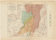
Geologic map of parts of Beek…
note:
Relief
shown by contours.
Topographical map of the stat…
note:
Relief
shown by contours and spot heights.
Alaska : Fortymile quadrangle
abstract:
Relief
shown by contours. At head of map
m
Massachusetts
note:
Relief
shown by contours.
Illinois--Missouri, St. Louis…
abstract:
Relief
shown by contours and spot heights
The gold and coal fields of A…
abstract:
Relief
shown by hachures and spot heights
Map of the Black and Grand pr…
abstract:
… at Oklahoma border.
Relief
Rochester and Ontario beach q…
note:
Relief
shown by contours and spot heights
Montana Helena sheet
note:
Relief
shown by contours.
Albany and vicinity
note:
Relief
shown by contours.
New Jersey (Sussex County) Fr…
note:
Relief
shown by contours and spot heights.
Montana, Helena special map
abstract:
Relief
shown by contours and spot heights
Omaha and vicinity : Nebraska…
note:
Relief
shown by contours and spot heights.
Mt. Washington and vicinity: …
note:
Relief
shown by contours, hachures and spot
California, Nevada City speci…
note:
Relief
shown by contours, hachures
Map of Alaska : showing explo…
abstract:
Relief
shown by hachures. Depth shown
Map of Alaska
abstract:
…, and missions.
Relief
shown
Colorado : Aspen special map
abstract:
…), and cities.
Relief
shown
Alaska military expedition : …
abstract:
Relief
shown by form lines. "Map 8
Location and depths of the ar…
abstract:
…] in the south.
Relief
show
Colorado, Tenmile District sp…
abstract:
Relief
shown by contours and spot heights
Explorations in Alaska, 1898 …
abstract:
Relief
shown by contours and land forms
California (Nevada Co.), Neva…
note:
Relief
shown by contours, hachures and spot
Explorations in Alaska, 1898 …
abstract:
Relief
shown by contours and spot heights