Click to visit the main New York Public Library Homepage
The New York Public Library
Digital Collections
About Digital Collections
Browse
Search only public domain materials
Items
Collections
Divisions
Home
Search
Browse
About
Search only public domain materials
Items
Collections
Divisions
Digital Collections
Using Images
Using Data
Search
Filtered keyword search
Show filters
Hide filters
Show Only Public Domain
topic
History
26
Harbors
5
Railroads
4
Administrative and political divisions
3
Canals
3
More
Less
name
American Civil War (1861-1865)
12
American Revolution (1775-1783)
5
United States Coast Survey
4
Albemarle and Chesapeake Canal Company
3
Krebs, Charles G
3
More
Less
collection
Maps of North America
37
Lawrence H. Slaughter Collection of English maps, charts, globes, books and atlases
4
place
x
United States
South Carolina
20
North Carolina
15
Virginia
10
Charleston (S.C.)
7
More
Less
genre
Maps
41
Military maps
2
Nautical charts
2
Bathymetric maps
1
Illustrations
1
More
Less
publisher
publisher not identified
3
Albemarle and Chesapeake Canal Company
2
Printed for J. Stockdale
2
U.S. Coast Survey Office
2
United States] War Department [Corps of Engineers
2
More
Less
division
x
Map Division
type
cartographic
41
still image
1
Date Range
to
41 results found for:
x
North Carolina
Filtering on:
x
Division
: Map Division
x
Place
: United States
Sort by:
Relevance
Title
Date created
Date digitized
Sequence
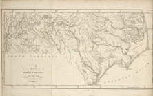
Johnson's
North
Carolina
and South
Carolina
… of Virginia,
North
Carolina
, South
Carolina
…'s topographical map of
North
and South
Carolina
…
abstract:
… of the states of
North
Carolina
, South
Carolina
and most
… & the
Carolinas
topic:
Sherman's March through the
Carolinas
…, Virginia, and
North
Carolina
, and also
Albemarle and Chesapeake Cana…
collection:
North
Carolina
…, Georgia, South
Carolina
,
North
Carolina
, Virginia
Middle Virginia and
North
Carolina
…
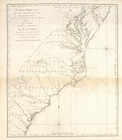
m
An accurate map of
North
and South
Carolina
Albemarle and Chesapeake Cana…
collection:
Maps of
North
America
Map of the Albemarle and Ches…
collection:
Maps of
North
America
An accurate map of
North
and South
Carolina
m
A new description of
Carolina
…
abstract:
…. Oriented with
north
A new map of
Carolina
…
To accompany Willard's histor…
collection:
Maps of
North
America
A new military map of the sea…
note:
…, and northern
North
Carolina
Plan of the western seat of w…
note:
…, and
North
Carolina
showing
A map of
North
Carolina
, from the best
Carte réduite du Sud des État…
abstract:
…, Maryland, Virginia,
North
Carolina
, South
Carolina
… of Virginia,
North
Carolina
, South
Carolina
Perrine's new topographical w…
note:
…, Virginia,
North
Carolina
, South
Carolina
, Georgia
Eastern Virginia showing the …
abstract:
…; and to Weldon,
North
Carolina
Map of the Southern States, i…
note:
…, and
North
Carolina
Map of eastern Virginia : com…
abstract:
…, and
North
Carolina
. Relief
United States of Nth. America…
… in South
Carolina
…
note:
…; "
North
Sand" is now "
North
Breaker
A general map of the southern…
collection:
…, comprehending
North
and South
Carolina
, Georgia, East
Plan of the siege of Charleston in S.
Carolina
…
… and South
Carolina
A map of Mexico, Louisiana, a…
topic:
Indians of
North
America
South-
Carolina
and parts adjacent …
New map of Charleston Harbor:…
abstract:
… to the
North
Edisto River
…
Carolina
…
Plan of the battle fought nea…
collection:
South
Carolina
Sketch of the battle of Hobki…
collection:
South
Carolina
Plan of Amelia Island in East…
note:
Taken from De Brahm's Map of South
Carolina
Plan of the French and Americ…
collection:
… [i.e.
Carolina
]
Florida, called by ye French …
abstract:
… and the
Carolinas
in the east, extending as far
north
Strategic war points of the U…
collection:
Maps of
North
America
Theatrum belli in America Sep…
note:
… to the
Carolinas
, and the interior
Map showing route of marches …
topic:
… the
Carolinas
End of results
|
Top