Click to visit the main New York Public Library Homepage
The New York Public Library
Digital Collections
About Digital Collections
Browse
Search only public domain materials
Items
Collections
Divisions
Home
Search
Browse
About
Search only public domain materials
Items
Collections
Divisions
Digital Collections
Using Images
Using Data
Search
Filtered keyword search
Show filters
Hide filters
Show Only Public Domain
topic
x
Fortification
History
4
Nautical charts
3
Buildings
1
Buildings, structures, etc
1
More
Less
name
American Civil War (1861-1865)
3
Bew, John, -1793
2
Colton, G. Woolworth (George Woolworth), 1827-1901
2
Gavit, John E., 1817-1874
2
Lodge, John, -1796
2
More
Less
collection
Maps of North America
6
Maps of New York City and State
4
Cartographic materials from the Emmet collection of manuscripts etc. relating to American history
1
Maps of Europe
1
place
New York (State)
3
Long Island (N.Y.)
2
Manhattan (New York, N.Y.)
2
New Jersey
2
New York (N.Y.)
2
More
Less
genre
Maps
12
Clippings
1
Early works to 1800
1
Military maps
1
Topographic maps
1
publisher
G. Woolworth Colton
2
publisher not identified
2
Bès et Dubreuil
1
D.Van Nostrand
1
Dept. of the Missouri?
1
More
Less
division
x
Map Division
type
cartographic
12
text
1
Date Range
to
12 results found for:
x
Engravings
Filtering on:
x
Division
: Map Division
x
Topic
: Fortification
Sort by:
Relevance
Title
Date created
Date digitized
Sequence
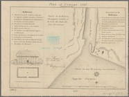
Plan of Oswego, 1727: (from P…
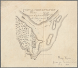
Fort la Présentation anno 174…
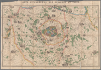
Carte pittoresque des environ…
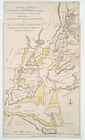
1863, West Point: [New York]
A map and chart of those part…
Chart and plan of the harbour…
Chart and plan of the harbour…
m
G. Woolworth Colton's 500 mil…
note:
Drawn
engraved
& published by G. Woolworth
G. Woolworth Colton's map of …
note:
Drawn,
engraved
& published by G. Woolworth
m
Military map of the Indian Te…
note:
… and
engraved
by Ado Hunnius
Sketch of Beaufort, Port Roya…
m
Map of n. eastern Virginia an…
End of results
|
Top