Click to visit the main New York Public Library Homepage
The New York Public Library
Digital Collections
About Digital Collections
Browse
Search only public domain materials
Items
Collections
Divisions
Home
Search
Browse
About
Search only public domain materials
Items
Collections
Divisions
Digital Collections
Using Images
Using Data
Search
Filtered keyword search
Show filters
Hide filters
Show Only Public Domain
topic
Indians of North America
9
Railroads
8
Administrative and political divisions
7
History
7
Indian reservations
5
More
Less
name
Northern Pacific Railroad Company
4
Poole Brothers
4
Julius Bien & Co
3
United States. General Land Office
3
Blaeu, Joan, 1596-1673
2
More
Less
collection
Maps of North America
33
Maps of New York City and State
5
Maps of North and South America
5
Lawrence H. Slaughter Collection of English maps, charts, globes, books and atlases
3
Atlases of New York City
1
place
Idaho
6
Western Hemisphere
5
New York
4
New York (State)
4
United States
4
More
Less
genre
Maps
46
Illustrations
4
Photographs
2
Topographic maps
2
Charts
1
More
Less
publisher
General Land Office
3
publisher not identified
3
Ioannes Ianssonius
2
Joan Blaeu
2
Northern Pacific Railroad
2
More
Less
division
x
Map Division
type
x
text
cartographic
45
still image
10
Date Range
to
47 results found for:
x
Reliefs
Filtering on:
x
Division
: Map Division
x
Type
: text
Sort by:
Relevance
Title
Date created
Date digitized
Sequence
m
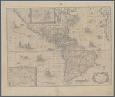
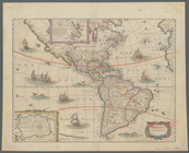
America noviter delineata
note:
Relief
shown pictorially
m
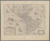
America noviter delineata
note:
Relief
shown pictorially
Map of the territory of Idaho
abstract:
… features.
Relief
shown
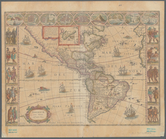
m
Americae nova tabula
note:
Relief
shown pictorially
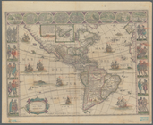
m
Americae nova tabula
note:
Relief
shown pictorially
Idaho
abstract:
… 1890s.
Relief
shown
m
Boston with its environs, 1776
note:
Relief
shown by hachures. Depths shown
m
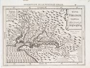
Nova Virginiae tabula
abstract:
Relief
shown pictorially. Covers Chesapeake
m
America noviter delineata
abstract:
Shows North and South America.
Relief
Plan of York Town in Virginia…
abstract:
…."
Relief
shown by hachures.
m
Official map of Georgia
abstract:
…, and congressional districts.
Relief
m
Map of Montana: compiled from…
abstract:
… agencies.
Relief
shown
Nova Virginiae tabvla
abstract:
… the right.
Relief
shown
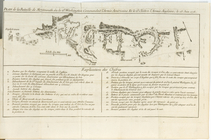
Plan de la Bataille de Montmo…
abstract:
… to upper left.
Relief
shown
Maps or plans and profiles, w…
note:
Relief
shown by contours.
m
Staten Island drive and bicyc…
abstract:
… Jersey.
Relief
shown
A geological and topographica…
note:
Relief
shown by contours.
m
Afro American travel map
abstract:
… to the upper left.
Relief
shown
m
Map [of the republic] of Texa…
abstract:
… features.
Relief
shown
A plan of the battle, on Bunk…
abstract:
Relief
shown by hachures and pictorially
m
Map of the northern portion o…
abstract:
… with north at right.
Relief
Territory of Idaho
abstract:
… of the territory.
Relief
shown
m
Map of Alaska and portions of…
abstract:
….
Relief
shown by shading
m
Faust's map of city and count…
abstract:
….
Relief
shown by hachures
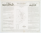
Attack of the rebels upon For…
abstract:
…, and names of ships.
Relief
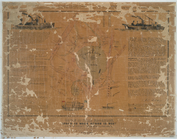
A view of Collect Pond and it…
note:
Relief
shown by hachures and depth
m
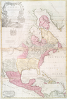
North America : : corrected f…
abstract:
Relief
shown pictorially. Covers continent
Amerique septentrionale divis…
abstract:
Relief
shown pictorially. California shown
A new plan of ye great town o…
abstract:
Relief
shown pictorially. Oriented
Territory of Idaho
abstract:
… of the territory.
Relief
shown
m
Map of the Denver & Rio Grand…
abstract:
… of Arizona.
Relief
shown
A view of Collect Pond and it…
note:
Relief
shown by hachures and depth
A survey of Lake Champlain: i…
abstract:
Relief
shown by hachures. Shows naval
A geographically correct map …
abstract:
… and Washington, D.C.
Relief
shown
m
Rand, McNally & Co.'s new bus…
abstract:
Relief
shown by hachures. Inset maps
State of Idaho
abstract:
…, D.C.
Relief
shown
m
Map of the Buffalo Hump minin…
abstract:
… logo on verso.
Relief
m
Map of the Yellowstone Nation…
abstract:
… and proposed railroads.
Relief
Nome City, Alaska, and vicini…
abstract:
….
Relief
shown by hachures
m
Climatic map of California
abstract:
….
Relief
shown by hachures
m
Map of Chickamauga & Chattano…
abstract:
… to northern Georgia.
Relief
Map of the centennial grounds…
abstract:
…."
Relief
shown by hachures
Map of Virginia and West Va.,…
note:
Relief
shown by hachures.
Map of explorations and surve…
abstract:
…, and exploration trails.
Relief
m
Vicinity map, Duwamish River …
abstract:
… and the Cascade Mountains.
Relief
Reconnaissance of the western…
abstract:
Depths shown by soundings.
Relief
shown
m
Preliminary agricultural map …
abstract:
… classification, etc.
Relief
shown
End of results
|
Top