Click to visit the main New York Public Library Homepage
The New York Public Library
Digital Collections
About Digital Collections
Browse
Search only public domain materials
Items
Collections
Divisions
Home
Search
Browse
About
Search only public domain materials
Items
Collections
Divisions
Digital Collections
Using Images
Using Data
Search
Filtered keyword search
Show filters
Hide filters
Show Only Public Domain
topic
Administrative and political divisions
425
Railroads
345
History
244
Landowners
224
Real property
218
More
Less
name
United States Coast Survey
129
Bache, A. D. (Alexander Dallas), 1806-1867
93
Burr, David H., 1803-1875
70
Bien, Julius, 1826-1909
62
Geological Survey (U.S.)
59
More
Less
collection
Maps of North America
1835
Maps of New York City and State
570
Lawrence H. Slaughter Collection of English maps, charts, globes, books and atlases
326
Atlases of the United States
64
Atlases of New York City
59
More
Less
place
New York (State)
541
United States
402
North America
215
New York (N.Y.)
198
Virginia
188
More
Less
genre
Maps
2973
Topographic maps
163
Cadastral maps
155
Nautical charts
104
Atlases
59
More
Less
publisher
publisher not identified
200
s.n
58
U.S. Coast Survey
51
U.S. Coast Survey Office
37
Topographical Bureau
34
More
Less
division
x
Map Division
type
cartographic
2970
still image
52
text
47
Date Range
to
Looking for this collection?
Maps of North America
3,345 items
2,976 results found for:
x
Reliefs
Filtering on:
x
Division
: Map Division
Sort by:
Relevance
Title
Date created
Date digitized
Sequence
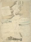
1863, West Point: [New York]
note:
Relief
shown by hachures
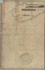
1889, Larchmont Harbor, N.Y.:…
note:
Relief
shown by contours. Depths shown
m
1896 Connecticut River, Conn.…
note:
… contours.
Relief
shown
7th map to accompany Willard'…
note:
Relief
shown by hachures.
A plan of part of the provin…
note:
Relief
shown by hachures.
A carefully prepared map of t…
abstract:
… natural features.
Relief
A chart of Delawar Bay : with…
note:
Relief
shown by hachures and shading
A chart of New York Harbour :…
note:
Relief
shown by hachures. Depths shown
A chart of New York Harbour :…
note:
Relief
shown by hachures and shading
A chart of New York Harbour :…
note:
Relief
shown by hachures and shading
A chart of New York Island & …
note:
Relief
shown by hachures. Depths shown
[A chart of New York Island &…
note:
Relief
shown by hachures. Depths shown
m
A chart of North and South Am…
note:
Relief
shown pictorially.
A chart of North and South Am…
note:
Relief
shown pictorially.
A chart of the bar of Sandy H…
note:
Relief
shown by hachures. Depths shown
A chart of the bar of Sandy H…
note:
Relief
shown by hachures. Depths shown
m
A chart of the British Channe…
note:
Relief
is represented by hachures
A chart of the coast of Ameri…
note:
Relief
shown by hachures in selected areas
A chart of the coast of New Y…
note:
Relief
shown by shading. Depths shown
m
A chart of the harbour of Rho…
abstract:
Relief
shown by shading and hachures
A chart of the sea coasts of …
note:
Relief
shown pictorially and depths shown
A chart of the West Indies fr…
note:
Relief
shown pictorially and depths shown
A chorographical map of the c…
note:
Relief
shown pictorially.
A chorographical map of the p…
note:
Relief
shown by hachures.
A chorographical map of the p…
note:
Relief
shown by hachures.
A compleat map of North-Carol…
abstract:
Facsimile map.
Relief
shown by hachures
A compleat map of North-Carol…
abstract:
…' names.
Relief
shown
A correct map of Connecticut:…
note:
Relief
shown by hachures.
m
A correct map of the state of…
abstract:
Relief
shown by hachures. Prime meridians
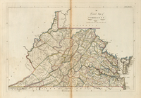
A correct map of Virginia
note:
Relief
shown by hachures.
A diagram of Oregon
abstract:
… and trails.
Relief
shown
A diagram of Oregon
abstract:
Relief
shown by hachures. "Sen. ex. doc. no
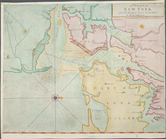
A draught of New York and Per…
note:
Relief
shown pictorially with depths
A draught of New York from th…
note:
Oriented with north to the right.
Relief
shown
A draught of New York from th…
note:
Relief
shown by hachures and shading
A general chart of all the co…
abstract:
Relief
shown by hachures and land forms
A General map of America divi…
note:
Relief
shown pictorially.
A general map of North Americ…
note:
Relief
shown pictorially.
A general map of North Americ…
note:
Relief
shown pictorially.
A general map of North Americ…
note:
Relief
shown pictorially.
A general map of the middle B…
note:
Relief
shown pictorially.
A general map of the middle B…
note:
Relief
shown pictorially.
A general map of the middle B…
note:
Relief
shown pictorially.
A general map of the northern…
note:
Relief
shown pictorially.
A general map of the southern…
note:
Relief
shown pictorially.
A general map of the world, o…
note:
Relief
shown pictorially.
A geographically correct map …
abstract:
… and Washington, D.C.
Relief
shown
A geological and topographica…
abstract:
Relief
shown by contours. Shows rock
A geological and topographica…
note:
Relief
shown by contours.
A geological and topographica…
note:
Relief
shown by contours.
1
2
3
4
5
6
7
8
9
10
11
12
Previous
Next
1
2
3
4
5
6
7
8
9
10
11
12
Previous
Next