Click to visit the main New York Public Library Homepage
The New York Public Library
Digital Collections
About Digital Collections
Browse
Search only public domain materials
Items
Collections
Divisions
Home
Search
Browse
About
Search only public domain materials
Items
Collections
Divisions
Digital Collections
Using Images
Using Data
Search
Filtered keyword search
Show filters
Hide filters
Show Only Public Domain
topic
Real property
25
Nautical charts
5
Railroads
5
Cities & towns
4
Coasts
4
More
Less
name
G.W. Bromley & Co
11
Beers, F. W. (Frederick W.)
7
G.M. Hopkins & Co
6
United States Coast Survey
6
Bache, A. D. (Alexander Dallas), 1806-1867
5
More
Less
collection
Atlases of New York City
25
Maps of North America
21
Atlases of the United States
8
Maps of New York City and State
1
place
New York (State)
31
New York
17
Brooklyn (New York, N.Y.)
13
Hudson River Valley (N.Y. and N.J.)
7
Manhattan (New York, N.Y.)
7
More
Less
genre
x
Maps
Atlases
8
Nautical charts
6
Topographic maps
2
Statistical maps
1
More
Less
publisher
G.W. Bromley & Co
9
Watson & co
7
G.M. Hopkins & Co
6
Sanborn Map Company
4
U.S. Coast Survey
4
More
Less
division
x
Map Division
type
cartographic
55
still image
1
Date Range
to
55 results found for:
x
Columbia River
Filtering on:
x
Division
: Map Division
x
Genre
: Maps
Sort by:
Relevance
Title
Date created
Date digitized
Sequence
Chart of the
Columbia
River
for 90 miles
Map of the Oregon Territory
abstract:
…:
Columbia
River
, reduced
Entrance to
Columbia
River
, Oregon …
Sketch J no. 2 showing the p…
note:
Insets:
Columbia
River
, Oregon, scale
m
… Monterey to the
Columbia
River
… of California to the
Columbia
River
note:
…
River
to the Pacific
No. 15 map of Oregon and Uppe…
abstract:
… of the
Columbia
River
from
Sketch J showing the progress…
note:
… --
Columbia
River
, Oregon
Reconnaissance of the western…
note:
Includes views: Entrance to
Columbia
River
Reconnaissance of the western…
note:
Includes views: Entrance to
Columbia
River
…; Green
River
[Village]; Green
River
Business
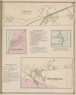
… of
Columbia
County.
… of
Columbia
County.
… of
Columbia
County.
… of
Columbia
County.
… of
Columbia
& Dutchess County.
… of
Columbia
& Dutchess County.
… of Rensselaer &
Columbia
County.
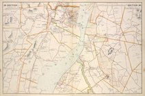
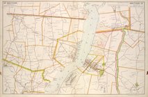
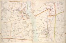
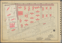
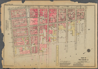
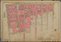
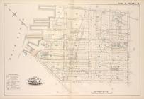
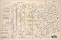
Plate 26, Part of Section 2: …
Plate 26, Part of Section 2: …
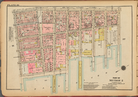
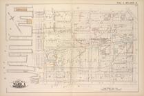
Plate 26: [Bounded by Columbi…
Bounded by
Columbia
Bounded by
Columbia
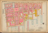
Plate 26, Part of Section 2: …
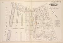
… Brunt Street (East
River
… by Congress St., East
River
, Atlantic Ave.,
Columbia
St.]
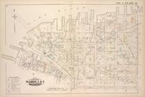
…
River
), Harrison Street,
Columbia
Street, Amity
…, Amity Street,
Columbia
… by East
River
, Joralemon St.,
Columbia
Place
… by
Columbia
St., Warren St., East
River
, Joralemon
… by
Columbia
St., President St., East
River
, Warren St.]
m
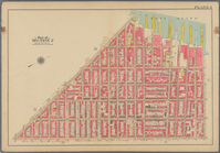
City of Washington, statistic…
note:
… (Georgetown), Anacostia
River
and Potomac
River
.
Route of the Albany & West St…
note:
Covers the area between the Hudson
River
…, Congress Street,
Columbia
…,
Columbia
Street, Atlantic Avenue and (East
River
collection:
… Street,Amity Street,
Columbia
Bounded by
Columbia
…, Woodhull Street,
Columbia
…., Harrison St., East
River
…., Baltic St., (East
River
Piers
Columbia
St
…., East
River
; Including
…., East
River
; Including
….,
Columbia
St., Verona St., East
River
; Including
…
River
, Bridge St., Sands
…., East
River
; Including
m
Map of Maury Co., Tennessee :…
abstract:
… Station -- Duck
River
….,
Columbia
Ave., Taylor Ave
m
… the Mississippi
River
note:
… of
Columbia
."…
North America west coast, Har…
m
… the Mississippi
River
note:
… of
Columbia
."…
m
… the Mississippi
River
note:
… of
Columbia
."…