Click to visit the main New York Public Library Homepage
The New York Public Library
Digital Collections
About Digital Collections
Browse
Search only public domain materials
Items
Collections
Divisions
Home
Search
Browse
About
Search only public domain materials
Items
Collections
Divisions
Digital Collections
Using Images
Using Data
Search
Filtered keyword search
Show filters
Hide filters
Show Only Public Domain
topic
Real property
10
Cities & towns
4
Fire insurance
4
Landowners
2
Bulkheads
1
More
Less
name
Sanborn Map Company
4
E.B. Hyde & Co
2
G.M. Hopkins & Co
2
Ullitz, Hugo
2
American Civil War (1861-1865)
1
More
Less
collection
Atlases of New York City
8
Maps of North America
2
Maps of New York City and State
1
place
New York (State)
9
New York
5
Brooklyn (New York, N.Y.)
4
Harlem (New York, N.Y.)
1
Jefferson City (La.)
1
More
Less
genre
x
Maps
Cadastral maps
1
Manuscript maps
1
publisher
Sanborn Map Company
4
E.B. Hyde & Co
2
G.M. Hopkins & Co
2
C. Bohn
1
J.Q.A. Fellows
1
division
x
Map Division
type
cartographic
11
Date Range
to
11 results found for:
x
Lynchings
Filtering on:
x
Division
: Map Division
x
Genre
: Maps
Sort by:
Relevance
Title
Date created
Date digitized
Sequence
Map of New Orleans and Jeffer…
note:
…
Lynch
, Surveyor General
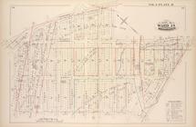
…., Marcy Ave.,
Lynch
St
… bounded by
Lynch
St
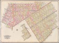
… Ave.,
Lynch
, Lee Ave.]
… bounded by
Lynch
, Marcy
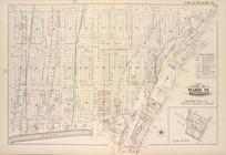
Map of New York City between …
note:
… to William
Lynch
, July 1st
…,
Lynch
Street, Broadway
…., Hayward St.,
Lynch
St
…., Heyward St.,
Lynch
St
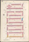
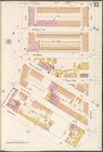
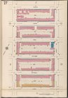
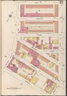
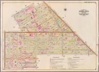
Bounded by Marcy Ave., Metrop…
collection:
… Ave., Broadway,
Lynch
m
Thirty five miles around Rich…
abstract:
…., from
Lynch
's map
End of results
|
Top