Click to visit the main New York Public Library Homepage
The New York Public Library
Digital Collections
About Digital Collections
Browse
Search only public domain materials
Items
Collections
Divisions
Home
Search
Browse
About
Search only public domain materials
Items
Collections
Divisions
Digital Collections
Using Images
Using Data
Search
Filtered keyword search
Show filters
Hide filters
Show Only Public Domain
topic
Maps
36
Railroads
18
Real property
17
Insurance
11
Rivers
11
More
Less
name
M.B. Brown Printing and Binding Co
108
New York (N.Y.). Board of Estimate and Apportionment
108
Perris & Browne
11
Perris, William
11
A. Brown & Co
8
More
Less
collection
Atlases of New York City
177
Maps of North America
42
Maps of New York City and State
29
Atlases of the United States
10
Lawrence H. Slaughter Collection of English maps, charts, globes, books and atlases
4
More
Less
place
New York (N.Y.)
114
New York (State)
46
New York
30
Brooklyn (New York, N.Y.)
23
United States
10
More
Less
genre
x
Maps
Atlases
10
Cadastral maps
7
Topographic maps
5
Bathymetric maps
3
More
Less
publisher
M.B. Brown Printing & Binding Co.,
108
Perris & Browne
32
A. Brown & Co
5
Advisory Board on Drainage
4
publisher not identified
4
More
Less
division
x
Map Division
type
cartographic
266
text
5
still image
4
Date Range
to
266 results found for:
x
The Brownings
Filtering on:
x
Division
: Map Division
x
Genre
: Maps
Sort by:
Relevance
Title
Date created
Date digitized
Sequence
Map of the United States and …
note:
published by Johnson &
Browning
under
Map of the consolidated city …
note:
…"Lith. by A.
Brown
... for William G. Bishop's Manual."…
… by Perris &
Browne
55
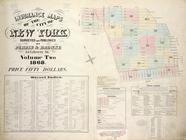
Map of the consolidated city …
note:
… in the Year 1861 by A.
Brown
Map of the consolidated city …
note:
… in the Year 1861 by A.
Brown
Map of the consolidated city …
note:
… in the Year 1861 by A.
Brown
Map of the consolidated city …
note:
… in the Year 1861 by A.
Brown
West Point
note:
…"Lithograph'd by T.B.
Brown
, U.S. Army."…
A new map of Virginia, Mary-l…
…. ; Richard C.
Brown
. ; Res. of The Late Richard C.
Brown
Map of the consolidated city …
note:
… in the Year 1861 by A.
Brown
m
… of the Bruce-
Brown
Land Co. 261
note:
… of the Bruce-
Brown
Land Co. 261 High
Plate I: General map of the P…
note:
…"Prepared by L.W.
Brown
, City Engineer
m
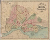
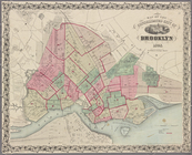
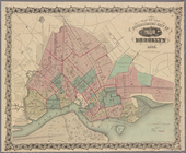
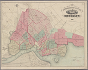
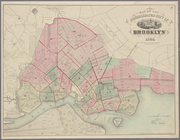
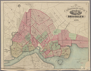
Map of the city of Brooklyn
note:
… in the Year 1861 by A.
Brown
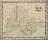
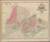
Map of the city of Brooklyn
note:
… in the [Year 1861 by] A.
Brown
County and township map, Mont…
Map of West Chester County, N…
m
Johnson's new illustrated & e…
note:
…"Published by Johnson and
Browning
, New
Whitesboro,
Brown
Co., W.T.
Plate IV: Map of New Orleans…
note:
…"Prepared by L.W.
Brown
, City Engineer
Plate II: Contour map of New …
note:
…"Prepared by L.W.
Brown
, City Engineer
Plate III: Map of New Orleans…
note:
…"Prepared by L.W.
Brown
, City Engineer
m
A chart of the discoveries of…
Map of the water region: adja…
Colton's new illustrated & em…
note:
… &
Browning
in the Clerks
Leavitt's map with views of t…
note:
…. ; engraved by S.E.
Brown
, 104
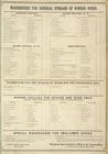
Warehouse for General Storage…
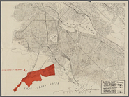
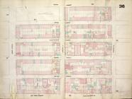
Map bounded by Fifth Street, …
m
Johnson's new illustrated & e…
note:
… for Johnson &
Browning
A map of the original allotme…
Maps of the City of New York
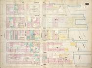
Map bounded by East 22nd Stre…
Map bounded by First Street, …
Map bounded by East 13th Stre…
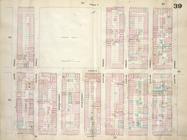
Map bounded by Second Avenue,…
Map bounded by Sixth Street, …
Map bounded by Avenue A, East…
Map bounded by East 17th Stre…
Map bounded by Sixth Street, …
Map of villa lots Arlington P…
note:
E.L.
Brown
, civil engineer.
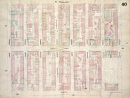
Map bounded by East Houston S…
Map bounded by Avenue A, East…
Map bounded by Fourth Avenue,…
Map bounded by Second Street,…
Map bounded by East 22nd Stre…
Map bounded by East 17th Stre…
m
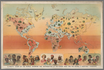
Climatic chart of the world :…
abstract:
… (
Brown
) races.
Map of part of Town of Fishki…
note:
Chas. C.
Brown
, C.E.
Map of the Forest Hill Divide…
note:
Based upon surveys and examinations of Ross E.
Browne
Map of the River Niagara and …
note:
by D. Jay
Browne
.
1
2
Previous
Next
1
2
Previous
Next