Click to visit the main New York Public Library Homepage
The New York Public Library
Digital Collections
About Digital Collections
Browse
Search only public domain materials
Items
Collections
Divisions
Home
Search
Browse
About
Search only public domain materials
Items
Collections
Divisions
Digital Collections
Using Images
Using Data
Search
Filtered keyword search
Show filters
Hide filters
Show Only Public Domain
topic
Administrative and political divisions
1
Altitudes
1
Canals
1
Charts, diagrams, etc
1
Distances, etc
1
More
Less
name
Paine, Thomas, 1737-1809
1
Phelps, Humphrey, 19th cent
1
Randel, John, Jr
1
Schenk, Peter, 1661-1711
1
T. & E.H. Ensign
1
More
Less
collection
Maps of New York City and State
2
Lawrence H. Slaughter Collection of English maps, charts, globes, books and atlases
1
place
x
Manhattan (New York, N.Y.)
New York (N.Y.)
3
New York (State)
2
Early works to 1800
1
genre
Maps
3
Road maps
1
Wall maps
1
publisher
David T. Valentine
1
T. & E.H. Ensign
1
s.n
1
division
x
Map Division
type
cartographic
2
still image
1
Date Range
to
3 results found for:
x
E. T
Filtering on:
x
Division
: Map Division
x
Place
: Manhattan (New York, N.Y.)
Sort by:
Relevance
Title
Date created
Date digitized
Sequence
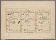
… in 1864 for David
T
parent:
8fb7
e
2c0-f092-0130-21d7-58d385a7b928
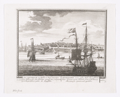
Distance map of the state of …
parent:
a202b2
e
0-c5a6-012f-9190-58d385a7bc34
… het geraekte in '
t
parent:
e
09da2d0-c5d4-012f-8138-58d385a7bc34