Click to visit the main New York Public Library Homepage
The New York Public Library
Digital Collections
About Digital Collections
Browse
Search only public domain materials
Items
Collections
Divisions
Home
Search
Browse
About
Search only public domain materials
Items
Collections
Divisions
Digital Collections
Using Images
Using Data
Search
Filtered keyword search
Show filters
Hide filters
Show Only Public Domain
topic
Harbors
2
Nautical charts
2
Administrative and political divisions
1
Canals
1
Railroads
1
More
Less
name
Bache, A. D. (Alexander Dallas), 1806-1867
2
Gilbert, S. A. (Samuel A.)
2
Gluck, J. B
2
United States Coast Survey
2
Ackerman, James, 1815 or 1816-1864
1
More
Less
collection
Maps of North America
3
Maps of New York City and State
1
place
x
Massachusetts
Boston
2
Boston Bay (Mass.)
1
Boston Harbor (Mass.)
1
Connecticut
1
More
Less
genre
Maps
4
Nautical charts
1
Topographic maps
1
publisher
U.S. Coast Survey
2
J. Disturnell
1
publisher not identified
1
division
x
Map Division
type
cartographic
4
Date Range
to
4 results found for:
x
John Smith
Filtering on:
x
Division
: Map Division
x
Place
: Massachusetts
Sort by:
Relevance
Title
Date created
Date digitized
Sequence
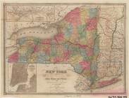
Map of the state of New York …
note:
by J. Calvin
Smith
Map of the town of Roxbury
note:
Surveyed by
John
G. Hales.
Boston Harbor, Massachusetts
note:
…"Verified, M.L.
Smith
, capt. topl. engrs
Preliminary chart of Monomoy …
note:
…"Engd. by J.V.N. Throop, W.
Smith
, & App