Click to visit the main New York Public Library Homepage
The New York Public Library
Digital Collections
About Digital Collections
Browse
Search only public domain materials
Items
Collections
Divisions
Home
Search
Browse
About
Search only public domain materials
Items
Collections
Divisions
Digital Collections
Using Images
Using Data
Search
Filtered keyword search
Show filters
Hide filters
Show Only Public Domain
topic
Administrative and political divisions
2
City planning
2
Railroads
2
Church buildings
1
Election districts
1
More
Less
name
Dripps, M. (Matthew)
1
Ed. W. Welcke & Bro
1
League for Political Education (U.S.)
1
M.I.T. Press
1
New York (N.Y.). City Planning Commission
1
More
Less
collection
Maps of New York City and State
4
Atlases of New York City
1
place
x
New York (N.Y.)
New York (State)
5
New York
4
Manhattan (New York, N.Y.)
2
Brooklyn (New York, N.Y.)
1
More
Less
genre
Maps
5
Manuscript maps
1
publisher
Gaylord Watson
1
M. Dripps (Ed. W. Welche & Bro. Photo-Lith. N.Y.)
1
MIT Press
1
The Company
1
producer not identified
1
division
x
Map Division
type
cartographic
4
still image
1
Date Range
to
5 results found for:
x
Police
Filtering on:
x
Division
: Map Division
x
Place
: New York (N.Y.)
Sort by:
Relevance
Title
Date created
Date digitized
Sequence
m
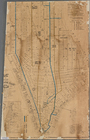
27th assembly district
note:
…, ward boundaries,
police
m
Watson's new map of New York,…
note:
Includes index to railway depots,
police
m
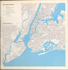
The Rand McNally map of the b…
topic:
Police
Police
precinct stations
m
Map of New York City south of…
note:
Street directory,
police
stations, post