Click to visit the main New York Public Library Homepage
The New York Public Library
Digital Collections
About Digital Collections
Browse
Search only public domain materials
Items
Collections
Divisions
Home
Search
Browse
About
Search only public domain materials
Items
Collections
Divisions
Digital Collections
Using Images
Using Data
Search
Filtered keyword search
Show filters
Hide filters
Show Only Public Domain
topic
Administrative and political divisions
481
Real property
371
Landowners
305
Railroads
289
History
96
More
Less
name
Burr, David H., 1803-1875
124
Rawdon, Clark & Co
81
Rawdon, Wright & Co
79
De Witt, Simeon, 1756-1834
60
New York (State). Surveyor General
48
More
Less
collection
Maps of North America
1169
Maps of New York City and State
486
Lawrence H. Slaughter Collection of English maps, charts, globes, books and atlases
281
Atlases of the United States
122
John H. Levine Collection
51
More
Less
place
New York (State)
459
New York (N.Y.)
247
United States
224
North America
163
New Jersey
139
More
Less
genre
Maps
2173
Cadastral maps
214
Atlases
122
Geological maps
32
Topographic maps
19
More
Less
publisher
publisher not identified
117
s.n
49
G.M. Hopkins (Firm)
42
... Sold ... by Tho. Bowles, print and map-seller in St. Paul's-Churchyard
30
G.W. & C.B. Colton & Co
27
More
Less
division
x
Map Division
type
cartographic
2169
still image
42
text
29
Date Range
to
2,176 results found for:
x
Hand
Filtering on:
x
Division
: Map Division
Sort by:
Relevance
Title
Date created
Date digitized
Sequence
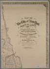
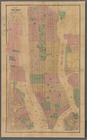
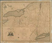
Map of New York, New England,…
note:
Photocopy of a manuscript map,
hand
colored.
Plan of the city of Philadelp…
note:
Fill color by
hand
Driving chart of Hartford and…
note:
…
hand
colored.
Carte de la Virginie et du Ma…
note:
NYPL copy
hand
col.
m
Map of the City of New York n…
note:
Hand
colored.
Map of the city of St. Louis,…
note:
NYPL copy
hand
col. at later date.
Novi Belgii Novaeque Angliae …
note:
Hand
col. …
Map of Warren County, Pennsyl…
abstract:
…, and tract acreages.
Hand
Orkney Islands
note:
Hand
coloured boundaries.
Amerika ĕst nor Ashkharhagrak…
note:
Hand
colored.
Map showing locations of Dela…
note:
… in upper-left
hand
corner.
Map of New York and vicinity …
note:
… right
hand
corner.
Bay and harbor of New York
note:
… and beacon
hand
col.
m
Geological map of the State o…
note:
Hand
colored to distinguish geological
m
Map of the City of New York n…
note:
Hand
colored.
m
Preliminary post route map of…
note:
… to be added by
hand
.
Skeleton map showing the rail…
note:
Railroad lines
hand
col. in red ink.
m
Map of Monroe County, New York
note:
Hand
colored to emphasize town (township
Agricultural and geological m…
note:
Hand
coloring to distinguish geological
A new map of North America fr…
Carte generale de l'Amerique …
m
Map of the City of New York, …
note:
Hand
colored.
Lloyd's map of the Canadas, N…
note:
Includes
hand
colored illustrations
Map of the City of New York, …
note:
Hand
colored.
Map of the City & County of N…
note:
Hand
colored.
Map of New York and vicinity
America
note:
…'s
Hand
-Atlas, No. 41."…
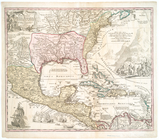
Regni Mexicani seu Novae Hisp…
A map of the State of New York
Carte nouvelle des posséssion…
London
m
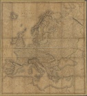
A new map of Europe : exhibit…
Colton's railroad & township …
abstract:
… and provinces.
Hand
colored
m
Sanitary & topographical map …
note:
Hand
colored.
m
The Wyoming Coal Field and it…
note:
…. 1 map :
hand
colored
A plan of Fort Montgomery & F…
note:
…].
Hand
col. ; 45 x 30 cm
m
Map of Rensselaer County, New…
note:
Hand
colored to emphasize town boundaries.
m
Map of Bedford County, Pa.
abstract:
…, and owners' names.
Hand
m
Colton's railroad & commercia…
note:
… with
hand
coloring.
m
12,000 Square Miles around Ne…
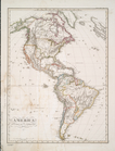
North America.
New World, or, Western Hemisp…
A new and accurate map of New…
A map of the United States of…
A map of the State of New York
Carte generale des treize Eta…
Chili, Paraguay, Bresil, Amaz…
Map of Massachusetts
America Borealis 1699.
Geologic map of Orange County…
1
2
3
4
5
6
7
8
9
Previous
Next
1
2
3
4
5
6
7
8
9
Previous
Next