Click to visit the main New York Public Library Homepage
The New York Public Library
Digital Collections
About Digital Collections
Browse
Search only public domain materials
Items
Collections
Divisions
Home
Search
Browse
About
Search only public domain materials
Items
Collections
Divisions
Digital Collections
Using Images
Using Data
Search
Filtered keyword search
Show filters
Hide filters
Show Only Public Domain
topic
Nautical charts
25
Coasts
7
Docks
7
Boundaries
6
Landowners
6
More
Less
name
United States Coast Survey
19
Bache, A. D. (Alexander Dallas), 1806-1867
16
Alden, James, 1810-1877
5
Mathiot, G
5
McCoy, G
5
More
Less
collection
Maps of North America
45
Atlases of New York City
7
Lawrence H. Slaughter Collection of English maps, charts, globes, books and atlases
7
Maps of New York City and State
6
John H. Levine Collection
3
More
Less
place
New York (State)
14
New York
9
Rhode Island
7
United States
7
Florida
4
More
Less
genre
Maps
69
Nautical charts
17
Bathymetric maps
4
Cadastral maps
2
Geological cross-sections
2
More
Less
publisher
U.S. Coast Survey Office
8
F. Heppenheimer
7
U.S. Coast Survey
4
U.S. Light-House Board
3
United States Coast Survey
3
More
Less
division
x
Map Division
type
cartographic
69
Date Range
to
69 results found for:
x
I. W. C. W
Filtering on:
x
Division
: Map Division
Sort by:
Relevance
Title
Date created
Date digitized
Sequence
Geo.
W
. Eldridge's chart B
parent:
46145950-a5e7-0134-b916-00505686a51
c
America, N.
W
. Coast, Strait of Juan de Fuca
parent:
7d109db0-
c
52a-012f-b115-3
c
075448cc4b
A new & exact map of the coas…
parent:
9
c
4bf3d0-1149-0133-ce0f-58d385a7b928
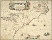
Virginiae partis australis, e…
parent:
1
c
606880-
c
6f1-012f-43d9-3
c
075448cc4b
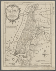
Map of Indian Territory
parent:
4162e680-
c
52b-012f-
c
2dc-3
c
075448cc4b
Map of the city of Washington
parent:
95
c
8fe00-
c
52b-012f-6380-3
c
075448cc4b
m
Map of original grants and fa…
parent:
cfa4dbd0-
c
5aa-012f-bd8d-58d385a7bc34
A compleat map of North-Carol…
parent:
52a622d0-b144-0132-78
c
9-58d385a7bbd0
Map of Narragansett Bay and a…
parent:
90
c
6a5
c
0-b144-0132-d3e3-58d385a7bbd0
Preliminary survey of Humbold…
parent:
42cc38b0-
c
52b-012f-4adf-3
c
075448cc4b
Preliminary chart of Kennebec…
parent:
1de59d40-a2
c
8-0134-478f-00505686a51
c
Virginiae partis australis, e…
parent:
2f1
c
3a90-
c
52b-012f-4b65-3
c
075448cc4b
Map of the Western Territory &
c
.
parent:
c
3ca05e0-322b-0133-4f54-58d385a7b928
Sketch
I
, showing the progress of the survey
parent:
0e905510-bc30-0135-2754-51
c
32ad7386f
m
Map of principal portion of P…
parent:
f65ae4
c
0-
c
40b-0135-1f3e-04f142d51daf
Cat and Ship Island harbors :…
parent:
4162e680-
c
52b-012f-
c
2dc-3
c
075448cc4b
Long Island Sound (western sh…
parent:
587bdb60-
c
5aa-012f-f824-58d385a7bc34
m
Map of New York
I
. …
parent:
ce8023d0-
c
5aa-012f-136a-58d385a7bc34
No. 3, map of Isle Royale in …
parent:
c
94a9640-b825-0135-795a-2f50604b9373
…, &
c
.]
parent:
87db1950-
c
5d5-012f-63bc-58d385a7bc34
… - Line,
W
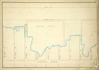
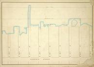
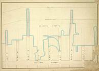
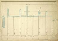
. 61st St, Eleventh Avenue,
W
. 53th St
parent:
4dea34d0-
c
603-012f-fa57-58d385a7bc34
… - Line,
W
. 53th St, Eleventh Avenue,
W
. 45th St
parent:
4d9dc860-
c
603-012f-430b-58d385a7bc34
… - Line,
W
. 36th St, Eleventh Avenue,
W
. 28th St
parent:
4d1b5fd0-
c
603-012f-1b30-58d385a7bc34
… - Line,
W
. 44th St, Eleventh Avenue,
W
. 36th St
parent:
4d64d4f0-
c
603-012f-6de9-58d385a7bc34
… - Line,
W
. 27th St, Eleventh Avenue,
W
.19th St
parent:
4ce50590-
c
603-012f-1acf-58d385a7bc34
…,
W
. 19th St, 10th Avenue,
W
. 12th St
parent:
4
c
9
c
3730-
c
603-012f-6488-58d385a7bc34
m
Map of the river Sainte Mary …
parent:
c
2e47e80-b143-0132-9cdd-58d385a7bbd0
…, &
c
.
parent:
89202d60-
c
5d5-012f-af15-58d385a7bc34
Map of Newport, R.
I
. …
parent:
90
c
6a5
c
0-b144-0132-d3e3-58d385a7bbd0
…, Antecosty, Sable, &
c
parent:
59e6e4e0-
c
5d5-012f-ce77-58d385a7bc34
Map of the city of Washington…
parent:
91a438
c
0-
c
52b-012f-bc7b-3
c
075448cc4b
Rappahannock River, Virginia …
parent:
3ba0
c
580-68d6-0135-df13-4b72a4264fa6
Map of the state of Kansas
parent:
48ef1620-
c
52b-012f-138d-3
c
075448cc4b
Detroit 1820
parent:
efa89bd0-b822-0135-b1e4-1b66aabcd1
c
0
…, Antecosty, Sable, &
c
parent:
5a7712a0-
c
5d5-012f-d51f-58d385a7bc34
Biloxi Bay, Mississippi : fro…
parent:
29702880-2eaa-0135-92ba-0d426a5169
c
1
Ceded part of Dakota Territor…
parent:
96cfaee0-d916-0135-db37-23dd29
c
51711
Key West Harbor and its appro…
parent:
4162e680-
c
52b-012f-
c
2dc-3
c
075448cc4b
Preliminary chart of Rappahan…
parent:
87229fd0-
c
52b-012f-390d-3
c
075448cc4b
m
Bureau of roads
parent:
be0d4620-
c
5aa-012f-12ef-58d385a7bc34
Map of the Rhode Island state…
parent:
24946640-
c
54a-0134-744f-00505686a51
c
Washington city
parent:
d8b77e40-
c
5d4-012f-135f-58d385a7bc34
Reconnaissance of the western…
parent:
c
3caa0b0-50fd-0134-6a48-00505686a51
c
Reconnaissance of the western…
parent:
63606b80-7396-0134-6412-00505686a51
c
Reconnaissance of the entranc…
parent:
49fc01f0-
c
52b-012f-0aff-3
c
075448cc4b
Little Egg Harbor
parent:
60f75b40-
c
52b-012f-a360-3
c
075448cc4b
Little Egg Harbor
parent:
61abca70-
c
52b-012f-2666-3
c
075448cc4b
Map of the state of Montana
parent:
e3
c
91230-b143-0132-d0bf-58d385a7bbd0
…, anthracite district,
C
[arbon
parent:
886f6df0-
c
091-0134-7ea0-00505686a51
c
Reconnaissance of the harbors…
parent:
42cc38b0-
c
52b-012f-4adf-3
c
075448cc4b