Click to visit the main New York Public Library Homepage
The New York Public Library
Digital Collections
About Digital Collections
Browse
Search only public domain materials
Items
Collections
Divisions
Home
Search
Browse
About
Search only public domain materials
Items
Collections
Divisions
Digital Collections
Using Images
Using Data
Search
Filtered keyword search
Show filters
Hide filters
Show Only Public Domain
topic
Indians of North America
133
Indian reservations
91
Administrative and political divisions
69
Railroads
63
Surveys
25
More
Less
name
United States. General Land Office
53
Julius Bien & Co
27
Bien, Julius, 1826-1909
26
Roeser, C. (Charles)
23
A.R. Ohman Map Co
12
More
Less
collection
Maps of North America
262
Maps of New York City and State
20
Lawrence H. Slaughter Collection of English maps, charts, globes, books and atlases
9
John H. Levine Collection
7
Maps of North and South America
4
More
Less
place
United States
60
North America
22
New York (State)
21
Oklahoma
20
West (U.S.)
20
More
Less
genre
Maps
302
Topographic maps
6
Early maps
5
Facsimiles
5
Cadastral maps
3
More
Less
publisher
General Land Office
29
publisher not identified
23
Department of the Interior, General Land Office
19
Museum of the American Indian, Heye Foundation
12
Surveyor General's Office
9
More
Less
division
x
Map Division
type
cartographic
301
text
12
still image
7
Date Range
to
303 results found for:
x
Indians of North America
Filtering on:
x
Division
: Map Division
Sort by:
Relevance
Title
Date created
Date digitized
Sequence
Native races of the Pacific S…
topic:
Indians
of
North
America
Map of the frontiers of the n…
topic:
Indians
of
North
America
Linguistic stocks of American
Indians
north
topic:
Indians
of
North
America
m
Map showing
Indian
abstract:
…: Hampton
Indian
pupils
Map showing
Indian
note:
Shows
Indian
Territory of Dakota
abstract:
… and
Indian
reservations. Also
… of Georgia in
North
America
topic:
Indians
of
North
America
Johnson's Missouri and Kansas
topic:
Indians
of
North
America
Johnson's Kansas and Nebraska
abstract:
…, marshland, and
Indian
m
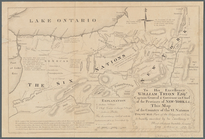
To his excellency William Try…
topic:
Indians
of
North
America
Map of the River Niagara and …
topic:
Indians
of
North
America
… the nations of far
Indians
abstract:
… Lakes region of
North
America
, from the eastern
… the Snake
Indians
in 1860 …
abstract:
…, military posts,
Indian
Parts of Ohio & Pennsylvania showing
Indian
abstract:
… to
Indian
settlements, shows
Linguistic families of American
Indians
north
note:
…
Indians
north
of Mexico
Indian
Territory …
abstract:
… of
Indian
reservations
Map no. 1 from San Francisco …
topic:
Indians
of
North
America
Map showing the progress of t…
abstract:
Shows township grid, existing towns,
Indian
… of the Cherokee "Nation
of
"
Indians
note:
… of present states
of
Bancroft's map of California,…
abstract:
… districts,
Indian
Map of Kansas and Nebraska : …
abstract:
Shows township grid, existing towns,
Indian
Sketch of the public surveys …
abstract:
… settlements and
Indian
Map of the Western Territory …
note:
Shows locations of
Indian
tribes.
Lovisiana by de Rivier Missis…
abstract:
… shown in Florida
north
Map of the State of Indiana :…
topic:
Indians
of
North
America
County and township map of Ar…
abstract:
Shows county and township boundaries,
Indian
… degree of
north
latitude
topic:
Indians
of
North
America
m
Map of Nebraska and Dakota an…
abstract:
… of
Indian
habitation by tribe,
Indian
Map of Alaska and adjoining r…
topic:
Indians
of
North
America
Johnson's Minnesota
abstract:
… of
Indian
habitation
Map of the
Indian
Territory …
topic:
Indians
of
North
America
Map showing the distribution …
topic:
Indians
of
North
America
A sketch of the Cherakee boun…
topic:
Indians
of
North
America
Aboriginal
America
east of the Mississippi
note:
Shows lands of various
Indian
tribes
… of the western &
north
-western
topic:
Indians
of
North
America
Johnson's Oregon and Washingt…
abstract:
… of
Indian
habitation
Map of
Indian
Territory
abstract:
…, and
Indian
reservations
An exact map of the five grea…
note:
Appears in The history of
America
, from
Map of the territory of Idaho
abstract:
Shows railroads, towns,
Indian
m
Dakota Territory
topic:
Indians
of
North
America
m
National map of the territory…
topic:
Indians
of
North
America
Map showing the progress of t…
abstract:
Shows township grid, existing towns,
Indian
Indian
Territory …
abstract:
…, boundaries of
Indian
… States of
America
note:
Shows estimates of some
Indian
populations
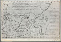
A diagram of the State of Ala…
topic:
Indians
of
North
America
m
National map of the territory…
note:
…, railroads,
Indian
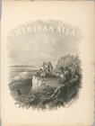
American atlas
topic:
Indians
of
North
America
… to emigrant
Indians
west
topic:
Indians
of
North
America
… States of
America
topic:
Indians
of
North
America
Werpoes, a village of the Manhattan
Indians
topic:
Indians
of
North
America
1
2
Previous
Next
1
2
Previous
Next