Click to visit the main New York Public Library Homepage
The New York Public Library
Digital Collections
About Digital Collections
Browse
Search only public domain materials
Items
Collections
Divisions
Home
Search
Browse
About
Search only public domain materials
Items
Collections
Divisions
Digital Collections
Using Images
Using Data
Search
Filtered keyword search
Show filters
Hide filters
Show Only Public Domain
topic
Indians of North America
3
Administrative and political divisions
2
Land grants
2
Historical geography
1
History
1
More
Less
name
Bien, Julius, 1826-1909
2
Evans, Lewis, 1700?-1756
2
Gibson, J. (John)
2
Jefferys, Thomas, -1771
2
Roeser, C. (Charles)
2
More
Less
collection
Maps of North America
5
Lawrence H. Slaughter Collection of English maps, charts, globes, books and atlases
1
place
America
2
Colonies
2
Great Britain
2
New Jersey
2
North America
2
More
Less
genre
Maps
6
publisher
Department of the Interior, General Land Office
1
General Land Office
1
Printed by James Parker, and a few Copies are to be Sold by him, and Benjamin Franklin, in Philadelphia;
1
Sold by T. Jefferys, Charing Cross
1
T. Jefferys
1
More
Less
division
x
Map Division
type
cartographic
6
Date Range
to
6 results found for:
x
Meridian (Miss.)
Filtering on:
x
Division
: Map Division
Sort by:
Relevance
Title
Date created
Date digitized
Sequence
Territory of Utah
abstract:
… by hachures. Prime
meridian
Map of the United States of A…
note:
Prime
meridians
: Washington and London.
Map no. I : [to accompany A b…
note:
Prime
meridian
: London.
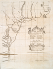
A general map of the middle B…
note:
Prime
meridians
: London and Philadelphia.
State of Louisiana : compiled…
note:
Prime
meridians
: Washington, D.C
A general map of the middle B…
note:
Prime
meridians
: London and Philadelphia.