Click to visit the main New York Public Library Homepage
The New York Public Library
Digital Collections
About Digital Collections
Browse
Search only public domain materials
Items
Collections
Divisions
Home
Search
Browse
About
Search only public domain materials
Items
Collections
Divisions
Digital Collections
Using Images
Using Data
Search
Filtered keyword search
Show filters
Hide filters
Show Only Public Domain
topic
Nautical charts
22
Coasts
16
Atlases, British
7
Railroads
7
Real property
7
More
Less
name
Thornton, Samuel
14
Bache, A. D. (Alexander Dallas), 1806-1867
9
United States Coast Survey
9
Robert Sayer and John Bennett (Firm)
8
Goos, Pieter, approximately 1616-1675
7
More
Less
collection
Maps of North America
50
Lawrence H. Slaughter Collection of English maps, charts, globes, books and atlases
24
Atlases, gazetteers, guidebooks and other books
23
Maps of North and South America
7
Maps of New York City and State
5
More
Less
place
North Sea
15
North America
11
New Jersey
10
South Carolina
10
Maps
9
More
Less
genre
Maps
112
Nautical charts
26
Bathymetric maps
11
Topographic maps
5
Cadastral maps
4
More
Less
publisher
P. Goos
7
Printed by A. Godbid and J. Playford, for John Seller ...,
5
U.S. Coast Survey
4
... Sold ... by Tho. Bowles, print and map-seller in St. Paul's-Churchyard
3
Joan Blaeu
3
More
Less
division
x
Map Division
type
cartographic
112
text
5
still image
2
Date Range
to
112 results found for:
x
North Sea
Filtering on:
x
Division
: Map Division
Sort by:
Relevance
Title
Date created
Date digitized
Sequence
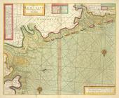
A chart of the
NORTH
SEA
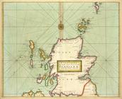
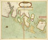
A new chart of the
sea
coast of SCOTLAND
… of the NORTHERN
SEAS
. Describing the
sea
coast and Islands
A chart of EEMS ELVE, Wefer, …
collection:
The
sea
A description of the coast FL…
collection:
The
sea
A chart of the
Sea
-Coast of ZEALAND from
A map of the icy
sea
in which
abstract:
…
North
Sea
" south to mid
A chart of the Eems of Old We…
collection:
The
sea
… to navigate the
North
Sea
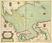
Pascaart van de Noort zee.
A chart of the Seacoasts of E…
collection:
The
sea
Pascaart van de Noord Zee, va…
Cust van Hollant tusschen de …
Pas-caart va Canaal vertoonen…
De Texel Stroom met de gaten …
… and 70
north
abstract:
Subject: Map of the northern part of
North
De cust van Zeelandt, begrype…
Pascaarte van Engelant, van't…
… the islands in the
North
Sea
… Rd.,
North
Sea
]
… of Ameirca in the
North
Sea
A new and exact map of the Un…
note:
Insets: Part of the South Britain,
North
Sea
Map of
Sea
Isle City, Ludlam Island
note:
Map oriented with
north
to the upper right.
Map showing the routes traver…
topic:
Sherman's March to the
Sea
m
A chart of
North
and South America
note:
… part of the Icy
Sea
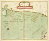
Map of the
Sea
-Coast of South Carolina …
abstract:
… with
north
toward upper left
Preliminary chart of the
sea
coast of
North
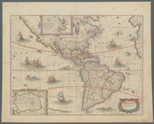
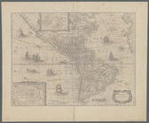
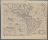
A chart of
North
and South America
note:
… of
North
and South America
m
An accurate map of
North
and South Carolina
An accurate map of
North
America from
note:
…,
sea
charts, city views
m
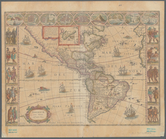
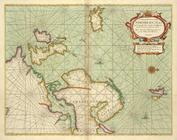
America noviter delineata
abstract:
Shows
North
Map of Black Point property n…
collection:
Maps of
North
America
m
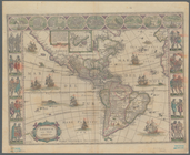
America noviter delineata
note:
Shows
North
and South America.
An accurate map of
North
and South Carolina
Map of
North
America
note:
…, and distances for
sea
routes
m
A new map of the River Missis…
note:
… Avenue
North
, St
A chart of the
sea
coast of New Foundland
m
America noviter delineata
note:
Shows
North
and South America.
Road map of 'he
sea
coast of Monmouth
… of ye South
Sea
Company
note:
… of the South-
Sea
-company, 1711.
Plan of Amelia Island in East…
note:
Appears in: Faden's
North
American atlas.
m
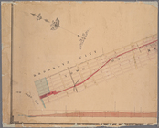
Map and profile of the New York and
Sea
Beach
abstract:
… with
north
at upper left
Beaufort Harbour,
North
Carolina …
abstract:
… detail and profile of
sea
L'Amerique septentrionale: dr…
note:
Shows some routes of exploration, land and
sea
.
Amerikanisch-Spanischer krieg…
collection:
Maps of
North
America
Explorations in Alaska, 1898 …
collection:
Maps of
North
America
m
Americae nova tabula
note:
Illustrated with
sea
monsters and ships
m
Americae nova tabula
note:
Illustrated with
sea
monsters and ships
A chart of the
sea
coast of New Foundland
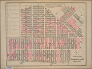
Index map to Bensonhurst-by-the
Sea
abstract:
… with
north
at upper left