Click to visit the main New York Public Library Homepage
The New York Public Library
Digital Collections
About Digital Collections
Browse
Search only public domain materials
Items
Collections
Divisions
Home
Search
Browse
About
Search only public domain materials
Items
Collections
Divisions
Digital Collections
Using Images
Using Data
Search
Filtered keyword search
Show filters
Hide filters
Show Only Public Domain
topic
History
44
Administrative and political divisions
41
Railroads
32
Landowners
28
Nautical charts
24
More
Less
name
Burr, David H., 1803-1875
21
Moll, Herman, -1732
20
Robert Sayer and John Bennett (Firm)
16
Heliotype Printing Co
15
Sayer, Robert, 1725-1794
14
More
Less
collection
Maps of North America
240
Lawrence H. Slaughter Collection of English maps, charts, globes, books and atlases
101
Maps of New York City and State
44
Atlases of the United States
20
John H. Levine Collection
8
More
Less
place
New York (State)
63
United States
62
North America
46
Virginia
42
Maps
35
More
Less
genre
Maps
419
Atlases
20
Cadastral maps
19
Topographic maps
13
Geological maps
11
More
Less
publisher
publisher not identified
25
For sale by the principal booksellers
20
Government Printing Office
10
Engraved, printed and published by G.W. & C.B. Colton & Co
7
Printed by H. Sweitzer, for M. Carey,
6
More
Less
division
x
Map Division
type
cartographic
421
text
4
still image
3
Date Range
to
421 results found for:
x
Relief prints
Filtering on:
x
Division
: Map Division
Sort by:
Relevance
Title
Date created
Date digitized
Sequence
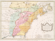
Western Hemisphere.
use:
Can be sold through 3rd party
print
Americae sive novi orbis, nov…
use:
Can be sold through 3rd party
print
A Map of America between lati…
use:
Can be sold through 3rd party
print
Americæ nova descriptio
use:
Can be sold through 3rd party
print
Map of eastern Virginia : com…
use:
Can be sold through 3rd party
print
m
Map of Belknap County, New Ha…
use:
Can be sold through 3rd party
print
Carte de la Virginie et du Ma…
use:
Can be sold through 3rd party
print
m
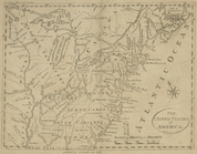
Map of the United States of A…
use:
Can be sold through 3rd party
print
Yorktown, armament of batteri…
use:
Can be sold through 3rd party
print
Yorktown, armament of batteri…
use:
Can be sold through 3rd party
print
Bird's eye view map of New Yo…
use:
Can be sold through 3rd party
print
Fort la Présentation anno 174…
use:
Can be sold through 3rd party
print
A new and correct map of Conn…
use:
Can be sold through 3rd party
print
m
The provinces of New York, an…
use:
Can be sold through 3rd party
print
A plan of Bahia del Espiritu …
use:
Can be sold through 3rd party
print
Map of Loudon [sic], Jefferso…
use:
Can be sold through 3rd party
print
Henrico County, Virginia: pre…
use:
Can be sold through 3rd party
print
Carte des possessions anglois…
use:
Can be sold through 3rd party
print
Part of Cobb Co., Ga
use:
Can be sold through 3rd party
print
Part of northern Georgia: no.…
use:
Can be sold through 3rd party
print
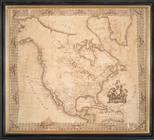
North America
use:
Can be sold through 3rd party
print
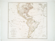
A General map of America divi…
use:
Can be sold through 3rd party
print
Pennsylvania.
use:
Can be sold through 3rd party
print
The United States of America
use:
Can be sold through 3rd party
print
m
The southern part of the Prov…
use:
Can be sold through 3rd party
print
A new map of North America fr…
use:
Can be sold through 3rd party
print
Map of the states of Virginia…
use:
Can be sold through 3rd party
print
A map of the United States.
use:
Can be sold through 3rd party
print
Proposed park system from the…
use:
Can be sold through 3rd party
print
m
Map of Kings and part of Quee…
use:
Can be sold through 3rd party
print
Map showing the public domain…
use:
Can be sold through 3rd party
print
Map of a portion of Virginia:…
use:
Can be sold through 3rd party
print
The town of Boston: in New En…
use:
Can be sold through 3rd party
print
Map of New York I. : with the…
use:
Can be sold through 3rd party
print
Map of New York I. : with the…
use:
Can be sold through 3rd party
print
North America, as divided amo…
use:
Can be sold through 3rd party
print
Chart of the entrance of Huds…
use:
Can be sold through 3rd party
print
A chart of the coast of New Y…
use:
Can be sold through 3rd party
print
Topographical map of Monadnoc…
use:
Can be sold through 3rd party
print
Map of the southern parts of …
use:
Can be sold through 3rd party
print
Precious metal regions of the…
use:
Can be sold through 3rd party
print
Stedman's new map of the city…
use:
Can be sold through 3rd party
print
Map of the United States and …
use:
Can be sold through 3rd party
print
Map of the state of New York …
use:
Can be sold through 3rd party
print
Poughkeepsie.
use:
Can be sold through 3rd party
print
The Theatre of war in North A…
use:
Can be sold through 3rd party
print
Profile shewing the general f…
use:
Can be sold through 3rd party
print
Map of Swanzey, 1890: [New Ha…
use:
Can be sold through 3rd party
print
Virginia
use:
Can be sold through 3rd party
print
Delaware and Mary-Land
use:
Can be sold through 3rd party
print
1
2
Previous
Next
1
2
Previous
Next