Click to visit the main New York Public Library Homepage
The New York Public Library
Digital Collections
About Digital Collections
Browse
Search only public domain materials
Items
Collections
Divisions
Home
Search
Browse
About
Search only public domain materials
Items
Collections
Divisions
Digital Collections
Using Images
Using Data
Search
Filtered keyword search
Show filters
Hide filters
Show Only Public Domain
topic
City planning
4
Social conditions
4
Cities and towns
1
Indian trails
1
Indians of North America
1
More
Less
name
M.I.T. Press
4
New York (N.Y.). City Planning Commission
4
A.R. Ohman Map Co
1
Beers, F. W. (Frederick W.)
1
Beers, S. N
1
More
Less
collection
Atlases of New York City
4
Maps of New York City and State
3
place
New York (State)
7
New York (N.Y.)
6
New York
5
Manhattan (New York, N.Y.)
2
Oneida County
1
More
Less
genre
Maps
7
Cadastral maps
1
publisher
MIT Press
4
J.E. Gillette
1
Museum of the American Indian, Heye Foundation
1
division
x
Map Division
type
still image
4
cartographic
3
Date Range
to
7 results found for:
x
Yorkville (New York, N.Y.)
Filtering on:
x
Division
: Map Division
Sort by:
Relevance
Title
Date created
Date digitized
Sequence
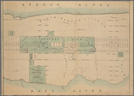
Map of
New
York
use:
… partner (e.g.,
New
York
Yorkville
and East Harlem in aboriginal
use:
… partner (e.g.,
New
York
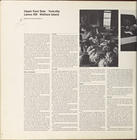
Upper West Side,
Yorkville
, Lenox Hill
collection:
Plan for
New
York
City 1969: a proposal
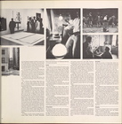
Upper West Side,
Yorkville
, Lenox Hill
collection:
Plan for
New
York
City 1969: a proposal
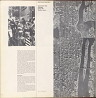
Upper West Side,
Yorkville
, Lenox Hill
collection:
Plan for
New
York
City 1969: a proposal
… West Side,
Yorkville
collection:
Plan for
New
York
City 1969: a proposal
m
Gillette's map of Oneida Co.,
New
York
use:
… partner (e.g.,
New
York