Click to visit the main New York Public Library Homepage
The New York Public Library
Digital Collections
About Digital Collections
Browse
Search only public domain materials
Items
Collections
Divisions
Home
Search
Browse
About
Search only public domain materials
Items
Collections
Divisions
Digital Collections
Using Images
Using Data
Search
Filtered keyword search
Show filters
Hide filters
Show Only Public Domain
topic
Real property
409
Maps
83
Administrative and political divisions
1
name
x
Bromley, George Washington
Bromley, Walter Scott
787
G.W. Bromley & Co
717
Boston (Mass.)
1
Geo. H. Walker & Co
1
collection
Atlases of New York City
717
Atlases of the United States
69
Maps of North America
1
place
New York
409
New York (State)
409
Manhattan (New York, N.Y.)
389
New York (N.Y.)
220
Bronx (New York, N.Y.)
152
More
Less
genre
x
Maps
Atlases
69
Index maps
16
Outline maps
7
Indexes
5
publisher
G.W. Bromley & Co
671
G.W. Bromley and Co.,
69
G.W. Bromley
46
publisher not identified
1
division
Map Division
787
type
x
cartographic
text
5
still image
3
Date Range
to
787 results found for:
x
Public libraries
Filtering on:
x
Genre
: Maps
x
Name
: Bromley, George Washington
x
Type
: cartographic
Sort by:
Relevance
Title
Date created
Date digitized
Sequence
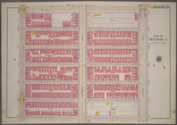
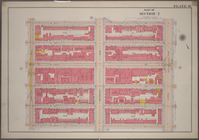
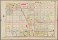
Bounded by E. 116th Street, S…
use:
… to the
public
)…
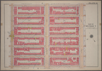
Bounded by W. 116th Street, P…
use:
… to the
public
)…
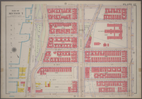
Bounded by W. 116th Street, E…
use:
… to the
public
)…
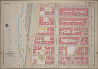
Bounded by W. 122nd Street, E…
use:
… to the
public
)…
Bounded by W. 122nd Street, L…
use:
… to the
public
)…
Bounded by E. 122nd Street, S…
use:
… to the
public
)…
Bounded by E, 127th Street, S…
use:
… to the
public
)…
Bounded by W. 139th Street, L…
use:
… to the
public
)…
Bounded by W. 145th Street, L…
use:
… to the
public
)…
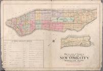
Outline map of the Borough of…
use:
… to the
public
)…
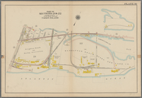
Coney Island: Part of Section…
use:
… to the
public
)…
Outline map of large scale re…
use:
… to the
public
)…
Bounded by W. 116th Street, E…
use:
… to the
public
)…
Bounded by W. 116th Street, L…
use:
… to the
public
)…
Bounded by W. 116th Street, A…
use:
… to the
public
)…
Bounded by W. 122nd Street, A…
use:
… to the
public
)…
Bounded by E. 122nd Street, (…
use:
… to the
public
)…
Bounded by W. 127th Street, L…
use:
… to the
public
)…
Bounded by W. 133rd Street, L…
use:
… to the
public
)…
Bounded by W. 139th Street, A…
use:
… to the
public
)…
Bounded by W. 145th Street, A…
use:
… to the
public
)…
Bounded by W. 145th Street, (…
use:
… to the
public
)…
Bounded by Flushing Avenue, N…
use:
… to the
public
)…
Outline Map of the Borough of…
use:
… to the
public
)…
Bounded by 58th Street, 21st …
use:
… to the
public
)…
Bounded by 72nd Street, 21st …
use:
… to the
public
)…
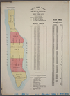
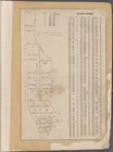
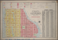
Block Index
use:
… to the
public
)…
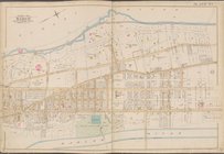
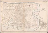
Map bounded by Hudson River, …
use:
… to the
public
)…
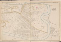
Map bounded by Hudson River, …
use:
… to the
public
)…
Bounded by Fourth Avenue, Pre…
use:
… to the
public
)…
Bounded by W. 122nd Street, E…
use:
… to the
public
)…
Bounded by E. 127th Street, F…
use:
… to the
public
)…
Bounded by W. 127th Street, E…
use:
… to the
public
)…
Bounded by W. 127th Street, M…
use:
… to the
public
)…
Bounded by W. 133d Street, Am…
use:
… to the
public
)…
Bound by W. 133rd Street (Con…
use:
… to the
public
)…
Bounded by W. 133rd Street, E…
use:
… to the
public
)…
Bounded by 43rd Street, 14th …
use:
… to the
public
)…
Bounded by 58th Street, Fourt…
use:
… to the
public
)…
Bounded by Rochester Avenue, …
use:
… to the
public
)…
Bounded by Kingston Avenue, M…
use:
… to the
public
)…
Bounded by 86th Street, W. 11…
use:
… to the
public
)…
Bounded by Avenue Q., Ocean A…
use:
… to the
public
)…
Plate 29: Bounded by Court St…
use:
… to the
public
)…
Bounded by Fourth Avenue, 38t…
use:
… to the
public
)…
Outline and Index Map of Atla…
use:
… to the
public
)…
BLOCK INDEX. [Includes the ma…
use:
… to the
public
)…
Bounded by Boulevard Lafayett…
use:
… to the
public
)…
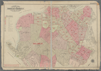
Outline and Index Map of Volu…
use:
… to the
public
)…
Bounded by W. 127th Street, E…
use:
… to the
public
)…
1
2
3
4
Previous
Next
1
2
3
4
Previous
Next