Click to visit the main New York Public Library Homepage
The New York Public Library
Digital Collections
About Digital Collections
Browse
Search only public domain materials
Items
Collections
Divisions
Home
Search
Browse
About
Search only public domain materials
Items
Collections
Divisions
Digital Collections
Using Images
Using Data
Search
Filtered keyword search
Show filters
Hide filters
Show Only Public Domain
topic
Railroads
21
Administrative and political divisions
8
Counties
3
Postal service
3
Canals
2
More
Less
name
Bew, John, -1793
2
Fish, W.R
2
Hale, Nathan, 1784-1863
2
Jefferys, Thomas, -1771
2
Johnson, A. J. (Alvin Jewett), 1827-1884
2
More
Less
collection
Maps of North America
34
Maps of New York City and State
3
Lawrence H. Slaughter Collection of English maps, charts, globes, books and atlases
2
place
x
New England
Connecticut
23
Massachusetts
22
Rhode Island
21
Vermont
8
More
Less
genre
x
Maps
Early maps
1
Manuscript maps
1
publisher
publisher not identified
6
A.J. Johnson
2
Gaylord Watson
2
J. Bew
2
Nathan Hale
2
More
Less
division
Map Division
39
type
cartographic
39
Date Range
to
39 results found for:
x
Connecticut
Filtering on:
x
Genre
: Maps
x
Place
: New England
Sort by:
Relevance
Title
Date created
Date digitized
Sequence
… &
Connecticut
m
… of Massachusetts,
Connecticut
Map of the
Connecticut
River Line
m
… of Massachusetts,
Connecticut
Massachusetts with
Connecticut
and Rhode Island
Massachusetts,
Connecticut
and Rhode-Island
Southern New England
collection:
Map of Massachusetts,
Connecticut
… of
Connecticut
and Massachusets
note:
… of
Connecticut
, southeastern
…, and
Connecticut
Johnson's Massachusetts,
Connecticut
Map of the New York & Boston …
note:
Covers
Connecticut
, Rhode Island
Map showing the New York and …
note:
Covers
Connecticut
, Rhode Island
… and
Connecticut
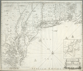
A map of the province of Mass…
…, and
Connecticut
Map of the state of New York:…
abstract:
Covers all of Vermont and
Connecticut
G. Woolworth Colton's series …
collection:
…,
Connecticut
and Lower Canada
Map of the rail roads of the …
abstract:
… and
Connecticut
, substantial
Map of Providence and Worcest…
note:
Covers Rhode Island,
Connecticut
, Massachusetts
… of
Connecticut
, Rhode Island
A new and accurate map of the…
note:
Covers New England to
Connecticut
River Valley
Map of Providence and Worcest…
note:
Covers Rhode Island,
Connecticut
, Massachusetts
Map showing the line of the N…
Map of New England, with adja…
Southern New England and New …
A map of the New England stat…
…,
Connecticut
, and Rhode Island
Map of New England with adjac…
A new map of New England, New…
note:
…,
Connecticut
, southeastern New
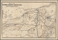
Map of the Fitchburg, Cheshir…
note:
… and
Connecticut
, portions of Maine
…,
Connecticut
, and Rhode Island
Map of the Eastern States: to…
note:
… of
Connecticut
."…
A map of the New England stat…
m
A map of the most inhabited p…
m
A map of the most inhabited p…
m
…, and
Connecticut
m
A map of the most inhabited p…
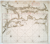
Pas-Kaart vande zee kusten va…
note:
… of
Connecticut
River.
m
…,
Connecticut
, and parts of New
End of results
|
Top