Click to visit the main New York Public Library Homepage
The New York Public Library
Digital Collections
About Digital Collections
Browse
Search only public domain materials
Items
Collections
Divisions
Home
Search
Browse
About
Search only public domain materials
Items
Collections
Divisions
Digital Collections
Using Images
Using Data
Search
Filtered keyword search
Show filters
Hide filters
Show Only Public Domain
topic
Real property
9
Landowners
7
History
6
Administrative and political divisions
3
Railroads
3
More
Less
name
L.H. Bradford & Co
2
B., J
1
Bayly, J
1
Beers, F. W. (Frederick W.)
1
Blodget, Samuel, 1724-1807
1
More
Less
collection
Maps of North America
17
Maps of New York City and State
12
place
New York (State)
11
Brooklyn (New York, N.Y.)
3
Massachusetts
3
New York
3
Alabama
2
More
Less
genre
x
Maps
Cadastral maps
4
Diagrams
1
Early works to 1800
1
Facsimiles
1
More
Less
publisher
x
publisher not identified
Lith of R.H. Pease
1
Weed Parsons & Co
1
division
Map Division
29
type
cartographic
29
text
1
Date Range
to
29 results found for:
x
32
Filtering on:
x
Genre
: Maps
x
Publisher
: publisher not identified
Sort by:
Relevance
Title
Date created
Date digitized
Sequence
m
Brooklyn City Hall
Florida
Mississippi & Alabama [1835]
Plan of the bay and island of…
Parts of 1st ward of the city…
m
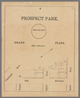
Prospect Park, plaza lots
Map of the city of Rochester:…
Plan of extension of Devonshi…
Plan of Louisville, Ky. and t…
Plan of extension of Devonshi…
Map of part of Jersey City, …
Historical map of Nantucket
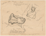
Ticonderoga and its dependenc…
note:
… and Putnam, 1841, page
32
.
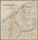
Map of Chautauqua County, N.Y…
Map of the city of Newport an…
A map of part of the land in …
Town of Bethel, Fairfield Co.…
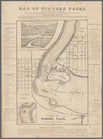
Map of Niagara Falls, and gui…
Map of the lakes & drives aro…
Plan of West Point
m
Map showing the injury to the…
A geological and topographica…
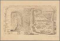
Plan of the siege of Charlest…
note:
….
32
.
Route of the Peninsula Railro…
A compleat map of North-Carol…
A map of a tract of land in t…
A prospective view of the bat…
Map of the state of Missouri …
note:
… 87°30ʹ/N 39°55ʹ--N
32
Plan of the French and Americ…
note:
…
32
°11ʹ23ʺ--N 31°53ʹ15ʺ).
End of results
|
Top