Click to visit the main New York Public Library Homepage
The New York Public Library
Digital Collections
About Digital Collections
Browse
Search only public domain materials
Items
Collections
Divisions
Home
Search
Browse
About
Search only public domain materials
Items
Collections
Divisions
Digital Collections
Using Images
Using Data
Search
Filtered keyword search
Show filters
Hide filters
Show Only Public Domain
topic
Real property
6
Canals
3
New England
3
Railroads
2
name
G.W. Bromley & Co
5
Burr, David H., 1803-1875
3
Rawdon, Clark & Co
3
Rawdon, Wright & Co
3
De Witt, Simeon, 1756-1834
2
More
Less
collection
x
Atlases of the United States
place
New York (State)
8
Westchester County (N.Y.)
6
Westchester County
5
New York (N.Y.)
3
New York (State) -- Administrative and political divisions -- Maps
2
More
Less
genre
x
Maps
Atlases
9
publisher
G.W. Bromley & Co
5
Bien, Joseph R
1
D. H. Burr
1
S. E. Morse & co.,
1
Stone and Clark
1
More
Less
division
Map Division
10
type
cartographic
10
Date Range
to
10 results found for:
x
Connecticut
Filtering on:
x
Genre
: Maps
x
Collection
: Atlases of the United States
For more collection details, visit the
Atlases of the United States collection page
.
Sort by:
Relevance
Title
Date created
Date digitized
Sequence
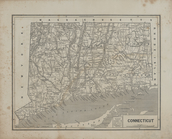
Connecticut
.
….,
Connecticut
]
… of
Connecticut
, White Plains
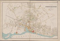
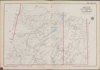
… of
Connecticut
, Poundridge
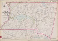
… of
Connecticut
, Bedford]
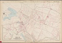
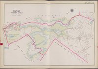
… of
Connecticut
, Town of harrison
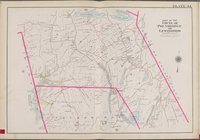
… of
Connecticut
, Lewisboto, Somers]
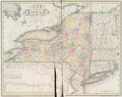
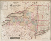
Map of the state of New-York …
note:
Covers also
Connecticut
, Rhode Island
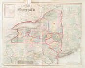
Map of the state of New-York …
note:
Covers also
Connecticut
, Rhode Island
Map of the state of New-York …
note:
Covers also
Connecticut
, Rhode Island