Click to visit the main New York Public Library Homepage
The New York Public Library
Digital Collections
About Digital Collections
Browse
Search only public domain materials
Items
Collections
Divisions
Home
Search
Browse
About
Search only public domain materials
Items
Collections
Divisions
Digital Collections
Using Images
Using Data
Search
Filtered keyword search
Show filters
Hide filters
Show Only Public Domain
topic
Geography
7
Atlases
2
Maps in education
2
Atlases, British
1
Geography, Ancient
1
More
Less
name
Coignet, Michel, 1549-1623
4
Moll, Herman, -1732
4
Ortelius, Abraham, 1527-1598
4
Shawe, James
4
Bowles, Thomas, 1694-1773
2
More
Less
collection
x
Lawrence H. Slaughter Collection of English maps, charts, globes, books and atlases
place
England
2
Great Britain
2
Netherlands
2
Friesland (Netherlands)
1
Gelderland (Netherlands)
1
More
Less
genre
x
Maps
publisher
Printed for Ieames Shawe, and are to be solde at his shoppe nigh Ludgate,
4
... Sold ... by Tho. Bowles, print and map-seller in St. Paul's-Churchyard
2
Printed for Timothy Childe at the White Hart at the West-end of St. Paul's Church-yard
2
Chapman and Hall
1
Printed at the Theater,
1
More
Less
division
Map Division
11
type
cartographic
11
Date Range
to
11 results found for:
x
Netherlands
Filtering on:
x
Genre
: Maps
x
Collection
: Lawrence H. Slaughter Collection of English maps, charts, globes, books and atlases
For more collection details, visit the
Lawrence H. Slaughter Collection of English maps, charts, globes, books and atlases collection page
.
Sort by:
Relevance
Title
Date created
Date digitized
Sequence
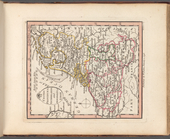
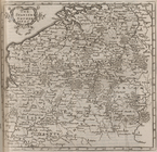
VII United Provinces,
Netherlands
…, or
Netherlands
&c.
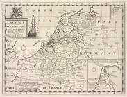
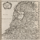
A new map of the
Netherlands
or Low Countries
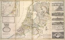
The
Netherlands
and Belgium
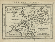
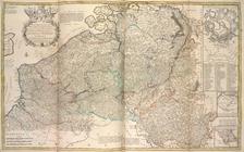
Geldria.
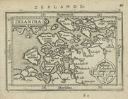
Zelandia.
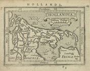
Hollandia.
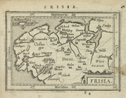
Frisia.
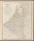
The Spanish
Netherlands
.
… of the United
Netherlands
.
…
Netherlands
&c.
End of results
|
Top