Click to visit the main New York Public Library Homepage
The New York Public Library
Digital Collections
About Digital Collections
Browse
Search only public domain materials
Items
Collections
Divisions
Home
Search
Browse
About
Search only public domain materials
Items
Collections
Divisions
Digital Collections
Using Images
Using Data
Search
Filtered keyword search
Show filters
Hide filters
Show Only Public Domain
topic
Atlases, British
3
Geography
3
Nautical charts
2
Description and travel
1
Pilot guides
1
name
Dunn, Samuel, d. 1794
3
Goos, Pieter, approximately 1616-1675
3
Sayer, Robert, 1725-1794
3
Jansson, Jan, 1588-1664
2
Thornton, Samuel
2
More
Less
collection
x
Atlases, gazetteers, guidebooks and other books
place
West Indies
7
Caribbean Area
2
Leeward Islands (West Indies)
2
Atlantic Ocean
1
Bergen (Norway)
1
More
Less
genre
x
Maps
Nautical charts
2
publisher
Printed for Robert Sayer, No. 53, Fleet-Street
3
P. Goos
3
Apud Haeredes J. Janssonii
2
Johnson and Ward
1
M. Carey
1
More
Less
division
Map Division
14
type
cartographic
14
Date Range
to
14 results found for:
x
West Indies
Filtering on:
x
Genre
: Maps
x
Collection
: Atlases, gazetteers, guidebooks and other books
For more collection details, visit the
Atlases, gazetteers, guidebooks and other books collection page
.
Sort by:
Relevance
Title
Date created
Date digitized
Sequence
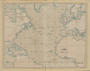
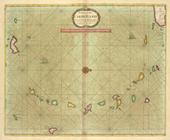
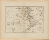
The Atlantic or Western Ocean
note:
… of the
West
Indies
.
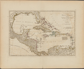
Pascaerte van't Eylant St. Ju…
A chart of the
West
Indies
, from the latest
m
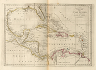
Johnson's
West
Indies
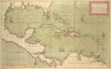
… of the tradeing part of the
WEST
INDIES
A chart of the CARIBE ILANDS
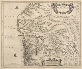
Episcopatus Bergensis
Dioecesis Trundhemiensis pars…
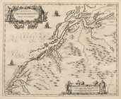
Pascaert van de Caribes Eylan…
… and South and the
West
Indies
...
…, and the
West
Indies
; Map
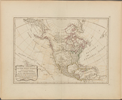
North America, with the
West
Indies
, wherein
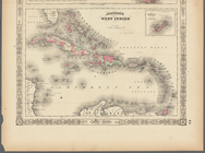
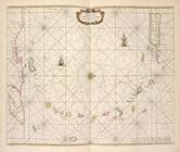
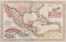
A compleat map of the
West
Indies
, containing
Pascaerte van Vlaemsche, Sout…
End of results
|
Top