Click to visit the main New York Public Library Homepage
The New York Public Library
Digital Collections
About Digital Collections
Browse
Search only public domain materials
Items
Collections
Divisions
Home
Search
Browse
About
Search only public domain materials
Items
Collections
Divisions
Digital Collections
Using Images
Using Data
Search
Filtered keyword search
Show filters
Hide filters
Show Only Public Domain
topic
x
Administrative and political divisions
Railroads
22
Canals
12
Roads
5
Counties
2
More
Less
name
G.W. & C.B. Colton & Co
4
Sweet, S. H. (Sylvanus Howe), 1830-1899
4
Geer, Elihu, 1817-1887
3
Richmond, Van Rensselaer, 1814?-
3
Walling, Henry Francis, 1825-1888
3
More
Less
collection
Maps of North America
27
Maps of New York City and State
19
place
Connecticut
31
New York (State)
20
Massachusetts
16
Vermont
13
New Jersey
10
More
Less
genre
x
Maps
Cadastral maps
1
Manuscript maps
1
Road maps
1
Tourist maps
1
publisher
publisher not identified
6
G.W. & C.B. Colton & Co
4
Geer
3
A.J. Johnson
2
J. Disturnell
2
More
Less
division
Map Division
46
type
cartographic
46
Date Range
to
46 results found for:
x
Connecticut
Filtering on:
x
Genre
: Maps
x
Topic
: Administrative and political divisions
Sort by:
Relevance
Title
Date created
Date digitized
Sequence
Map of
Connecticut
showing counties
Map of
Connecticut
note:
… of
Connecticut
by counties
Connecticut
Connecticut
… of
Connecticut
collection:
The Matthews-Northrup up-to-date map of
Connecticut
Map of
Connecticut
m
… of
Connecticut
note:
… of
Connecticut
."…
Connecticut
The state of
Connecticut
Ancient Windham County: names…
note:
…,
Connecticut
, 1874.
A map of the colonies of
Connecticut
Connecticut
Massachusetts with
Connecticut
and Rhode Island
m
Map of New London County,
Connecticut
Southern New England
collection:
Map of Massachusetts,
Connecticut
…, and
Connecticut
Johnson's Massachusetts,
Connecticut
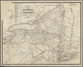
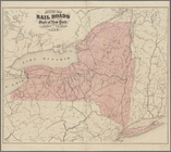
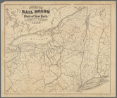
Map of the rail roads of the …
note:
… and
Connecticut
, substantial
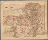
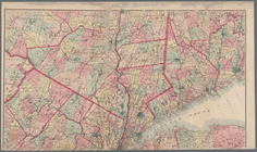
Map of New York
note:
Covers most of Vermont and
Connecticut
…, and
Connecticut
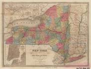
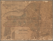
Map of the state of New York:…
abstract:
Covers all of Vermont and
Connecticut
Town of Ridgefield, Fairfield…
collection:
Connecticut
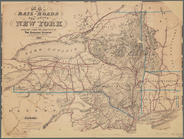
Map of the rail-roads of the …
Map of the rail-roads of the …
Map of the state of New York …
note:
Also cover Vermont,
Connecticut
, and part of New
Map of the rail roads of the …
note:
… and
Connecticut
, substantial
Geer's New map of the city of…
collection:
Connecticut
Geer's new map of the city of…
collection:
Connecticut
Map of New England, with adja…
Geer's map of the city of Har…
collection:
Connecticut
Map of New England with adjac…
Map of the city of New Haven:…
collection:
Connecticut
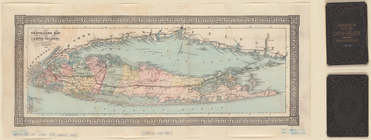
Travellers map of Long Island
note:
… of
Connecticut
.
m
Map of New York and vicinity:…
Revised map of the rail roads…
note:
… of Vermont and
Connecticut
Map of the state of New York …
note:
Also covers Vermont,
Connecticut
, and part of New
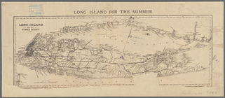
Long Island for the summer
note:
… of
Connecticut
.
m
… of
Connecticut
Revised map of the rail roads…
note:
… Vermont and
Connecticut
Map of Rhode Island and Provi…
note:
From: A gazetteer of the states of
Connecticut
Engineers map of the state of…
Northern coast of Long Island…
New Hampshire & Vermont
note:
…,
Connecticut
, New York, and New
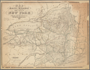
Map of the rail-roads of the …
m
Colton's new map of Long Isla…
abstract:
… of
Connecticut
.
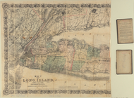
Map of Long Island: showing t…
note:
… of
Connecticut
.
End of results
|
Top