Click to visit the main New York Public Library Homepage
The New York Public Library
Digital Collections
About Digital Collections
Browse
Search only public domain materials
Items
Collections
Divisions
Home
Search
Browse
About
Search only public domain materials
Items
Collections
Divisions
Digital Collections
Using Images
Using Data
Search
Filtered keyword search
Show filters
Hide filters
Show Only Public Domain
topic
x
Nautical charts
Coasts
5
Harbors
3
Navigation
2
Harbors of refuge
1
More
Less
name
Hassler, F. R. (Ferdinand Rudolph), 1770-1843
5
United States Coast Survey
5
Bache, A. D. (Alexander Dallas), 1806-1867
4
Rollé, A
4
Benham, Henry Washington, 1813-1884
3
More
Less
collection
Maps of North America
5
Maps of New York City and State
4
Lawrence H. Slaughter Collection of English maps, charts, globes, books and atlases
2
place
Connecticut
8
Long Island Sound (N.Y. and Conn.)
6
Atlantic Coast
3
Long Island (N.Y.)
3
New York (State)
3
More
Less
genre
x
Maps
Nautical charts
4
Bathymetric maps
1
publisher
U.S. Coast Survey office
3
U.S. House of Representatives
2
By Johannis van Keulen, boek en zee kaart verkoper, aande Niewe Brugh, inde Gekroonde Lootsman,
1
Coast Survey Office
1
Pub. by E.M. Blunt for W. Hooker
1
More
Less
division
Map Division
11
type
cartographic
11
Date Range
to
11 results found for:
x
Connecticut
Filtering on:
x
Genre
: Maps
x
Topic
: Nautical charts
Sort by:
Relevance
Title
Date created
Date digitized
Sequence
m
1896
Connecticut
River, Conn., from
Harbors of Sheffield Island a…
collection:
Connecticut
m
Map of the portion of the
Connecticut
River between
Harbors of Captain's Island E…
collection:
Connecticut
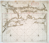
Middle part of Long Island So…
Part of New England, New York…
m
Eastern part of Long Island S…
Long Island Sound (western sh…
Long Island Sound from New Yo…
Pas-Kaart vande zee kusten va…
note:
… of
Connecticut
River.
Chart of Long Island Sound, 1…
End of results
|
Top