Click to visit the main New York Public Library Homepage
The New York Public Library
Digital Collections
About Digital Collections
Browse
Search only public domain materials
Items
Collections
Divisions
Home
Search
Browse
About
Search only public domain materials
Items
Collections
Divisions
Digital Collections
Using Images
Using Data
Search
Filtered keyword search
Show filters
Hide filters
Show Only Public Domain
topic
x
Railroads
Administrative and political divisions
15
Roads
11
Local transit
10
Canals
3
More
Less
name
Rand McNally and Company
5
G.W. & C.B. Colton & Co
4
C.S. Hammond & Company
3
Connecticut. Railroad Commissioners
3
Taunton, S. D. L
3
More
Less
collection
Maps of New York City and State
33
Maps of North America
3
place
New York (State)
31
Long Island (N.Y.)
18
New York
17
New York (N.Y.)
11
Brooklyn (New York, N.Y.)
9
More
Less
genre
x
Maps
Tourist maps
3
Road maps
2
publisher
G.W. & C.B. Colton & Co
5
Railroad Commissioners?
3
The Company
3
C.S. Hammond
2
Gaylord Watson
2
More
Less
division
Map Division
36
type
cartographic
36
Date Range
to
36 results found for:
x
Long Island City (New York, N.Y.)
Filtering on:
x
Genre
: Maps
x
Topic
: Railroads
Sort by:
Relevance
Title
Date created
Date digitized
Sequence
New
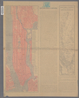
map of Brooklyn including Kings Co.
use:
… partner (e.g.,
New
York
m
… of
New
York
City
use:
… partner (e.g.,
New
York
m
… of
New
York
City
use:
… partner (e.g.,
New
York
m
… of
New
York
City
use:
… partner (e.g.,
New
York
m
Watson's
new
map of
New
York
and adjacent
use:
… partner (e.g.,
New
York
m
Watson's
new
map of
New
York
and adjacent
use:
… partner (e.g.,
New
York
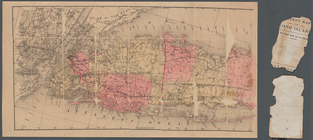
Long
Island
for the summer
use:
… partner (e.g.,
New
York
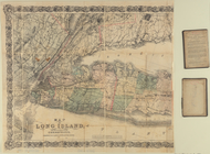
Map of
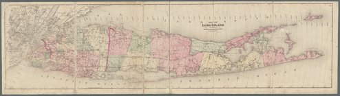
Long
Island
use:
… partner (e.g.,
New
York
m
Map of
Long
Island
use:
… partner (e.g.,
New
York
Map of
Long
Island
use:
… partner (e.g.,
New
York
m
Map of
Long
Island
and the southern part
use:
… partner (e.g.,
New
York
m
Colton's road map of
Long
Island
use:
… partner (e.g.,
New
York
Colton's road map of
Long
Island
use:
… partner (e.g.,
New
York
m
Hagstom's map of
Long
Island
New
York
use:
… partner (e.g.,
New
York
m
Colton's
new
map of
Long
Island
use:
… partner (e.g.,
New
York
Map of
Long
Island
showing the
Long
Island
use:
… partner (e.g.,
New
York
m
… of
New
York
: the imperial
city
of the
new
use:
… partner (e.g.,
New
York
Hammond's
new
guide map of Manhattan
use:
… partner (e.g.,
New
York
m
Hammond's
new
guide map of Manhattan
use:
… partner (e.g.,
New
York
Rand, McNally & Co.'s
New
York
use:
… partner (e.g.,
New
York
… of
New
York
use:
… partner (e.g.,
New
York
Map of the State of
New
York
use:
… partner (e.g.,
New
York
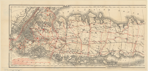
Railroad suburbs between Holl…
use:
… partner (e.g.,
New
York
m
… miles around
New
York
City
use:
… partner (e.g.,
New
York
m
….'s map of
New
York
City
, Brooklyn, Jersey
use:
… partner (e.g.,
New
York
Street guide of Brooklyn : wi…
use:
… partner (e.g.,
New
York
m
Guide-map of
New
York
City
use:
… partner (e.g.,
New
York
m
Map of the
city
of
New
York
use:
… partner (e.g.,
New
York
m
Higginson's plan of the
city
of Brooklyn, L.I.
use:
… partner (e.g.,
New
York
… around
New
York
…
use:
… partner (e.g.,
New
York
Map of the railroads of Conne…
use:
… partner (e.g.,
New
York
Map of the railroads of Conne…
use:
… partner (e.g.,
New
York
Map of the railroads of Conne…
use:
… partner (e.g.,
New
York
… counties
Long
Island
New
York
…
use:
… partner (e.g.,
New
York
Rand, McNally & Co.'s
New
York
use:
… partner (e.g.,
New
York
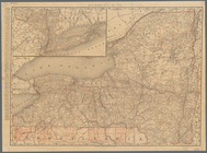
Railroad map of the State of
New
York
use:
… partner (e.g.,
New
York
End of results
|
Top