Click to visit the main New York Public Library Homepage
The New York Public Library
Digital Collections
About Digital Collections
Browse
Search only public domain materials
Items
Collections
Divisions
Home
Search
Browse
About
Search only public domain materials
Items
Collections
Divisions
Digital Collections
Using Images
Using Data
Search
Filtered keyword search
Show filters
Hide filters
Show Only Public Domain
topic
x
Real property
Administrative and political divisions
4
Landowners
4
Canals
1
Ferries
1
More
Less
name
Pease, Richard H., 1813-1869
2
Sauthier, Claude Joseph
2
Vaughan, David, active 1849-1864
2
C.B. Graham's Lith
1
Cornell, Silas, 1788 or 1789-1864
1
More
Less
collection
Maps of New York City and State
5
Maps of North America
2
place
New York (State)
5
Brooklyn (New York, N.Y.)
2
New York
2
Pennsylvania
2
Brooklyn
1
More
Less
genre
x
Maps
Cadastral maps
3
publisher
publisher not identified
2
J.H. Higginson
1
M. Dripps
1
United Petroleum Farms Association?
1
division
Map Division
7
type
cartographic
7
Date Range
to
7 results found for:
x
new york city 1864
Filtering on:
x
Genre
: Maps
x
Topic
: Real property
Sort by:
Relevance
Title
Date created
Date digitized
Sequence
Map of the oil region, Venang…
use:
… partner (e.g.,
New
York
m
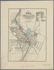
Higginson's plan of the
city
of Brooklyn, L.I.
use:
… partner (e.g.,
New
York
The Cornplanters Reserve, Ven…
use:
… partner (e.g.,
New
York
m
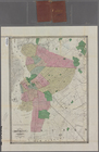
Map of Brooklyn and vicinity
use:
… partner (e.g.,
New
York
Map of the
city
of Rochester
use:
… partner (e.g.,
New
York
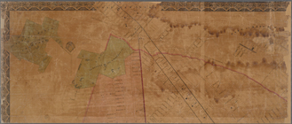
… of
New
York
in North
use:
… partner (e.g.,
New
York
… of
New
York
in North
use:
… partner (e.g.,
New
York