Click to visit the main New York Public Library Homepage
The New York Public Library
Digital Collections
About Digital Collections
Browse
Search only public domain materials
Items
Collections
Divisions
Home
Search
Browse
About
Search only public domain materials
Items
Collections
Divisions
Digital Collections
Using Images
Using Data
Search
Filtered keyword search
Show filters
Hide filters
Show Only Public Domain
topic
Landowners
2
Real property
2
Atlases
1
Buildings
1
Cities and towns
1
More
Less
name
H.F. Walling's Map Establishment
2
Walling, Henry Francis, 1825-1888
2
Adam and Charles Black (Firm)
1
Di Gara, Giovanni, active 1564-1610
1
Farissol, Abraham ben Mordecai (ca. 1451-ca. 1525)
1
More
Less
collection
Maps of North America
2
Atlases, gazetteers, guidebooks and other books
1
Igeret Orḥot ʻolam : ha-melamedet adam daʻat ḥelḳe ha-7 aḳlimim
1
place
America
1
Berkshire County
1
Berkshire County (Mass.)
1
Clinton County
1
Clinton County (Ohio)
1
More
Less
genre
x
Maps
Illustrations
3
Cadastral maps
2
Pictorial works
1
publisher
A. and C. Black
1
Juan de Gara
1
Smith, Gallup & Co
1
Walling, Rice & Moon
1
division
Map Division
3
Dorot Jewish Division
1
type
x
still image
cartographic
4
Date Range
to
4 results found for:
x
Adam
Filtering on:
x
Genre
: Maps
x
Type
: still image
Sort by:
Relevance
Title
Date created
Date digitized
Sequence
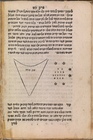
Map of the New World
collection:
Igeret Orḥot ʻolam : ha-melamedet
adam
daʻat ḥelḳe
Ethnological Chart of the Wor…
m
Map of the county of Berkshir…
note:
…; Dalton; North
Adams
; Hinsdale; South
Adams
Map of Clinton County, Ohio
abstract:
…), Sligo (
Adams
), Oakland