Click to visit the main New York Public Library Homepage
The New York Public Library
Digital Collections
About Digital Collections
Browse
Search only public domain materials
Items
Collections
Divisions
Home
Search
Browse
About
Search only public domain materials
Items
Collections
Divisions
Digital Collections
Using Images
Using Data
Search
Filtered keyword search
Show filters
Hide filters
Show Only Public Domain
topic
Railroads
53
Administrative and political divisions
46
Canals
19
Real property
18
Nautical charts
11
More
Less
name
United States Coast Survey
8
G.W. & C.B. Colton & Co
6
Carrère & Hastings
5
Connecticut. Commission on Boundary between the States of New York and Connecticut
5
G.W. Bromley & Co
5
More
Less
collection
Maps of North America
128
Maps of New York City and State
57
Lawrence H. Slaughter Collection of English maps, charts, globes, books and atlases
13
Atlases of the United States
10
A plan of the city of Hartford
5
More
Less
place
Connecticut
122
New York (State)
73
Massachusetts
44
New England
39
Rhode Island
34
More
Less
genre
x
Maps
Cadastral maps
11
Atlases
9
Early maps
6
Plans
5
More
Less
publisher
publisher not identified
29
Case, Lockwood & Brainard Co
5
G.W. & C.B. Colton & Co
5
G.W. Bromley & Co
5
The Commissioners
5
More
Less
division
Map Division
215
General Research Division
5
Wallach Division: Print Collection
2
Rare Book Division
1
type
cartographic
223
still image
1
Date Range
to
223 results found for:
x
Connecticut
Filtering on:
x
Genre
: Maps
Sort by:
Relevance
Title
Date created
Date digitized
Sequence
Historical map of the state of
Connecticut
General plan of the city of H…
Diagrammatic plan for a moder…
General plan of the city of H…
Plan of the central section o…
Suggested type of layout for …
… of
Connecticut
, White Plains
… of
Connecticut
, Town of harrison
… of
Connecticut
, Lewisboto, Somers]
… of
Connecticut
, Poundridge
… of
Connecticut
, Bedford]
m
Map of
Connecticut
note:
… of
Connecticut
.
Map of
Connecticut
showing counties
Map of the railroads of
Connecticut
note:
Covers
Connecticut
, Massachusetts, Rhode Island
… of
Connecticut
collection:
The Matthews-Northrup up-to-date map of
Connecticut
m
1896
Connecticut
River, Conn., from
m
Map of the portion of the
Connecticut
River between
Map of the railroads of
Connecticut
abstract:
Covers
Connecticut
, Massachusetts, Rhode Island
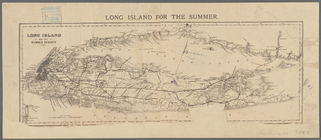
Long Island for the summer
note:
… of
Connecticut
.
… of
Connecticut
Map of
Connecticut
note:
… of
Connecticut
by counties
Map of property owned by the …
collection:
Connecticut
… &
Connecticut
Norwich circ. 1830: a boyish …
collection:
Connecticut
Map of the railroads of
Connecticut
note:
Covers
Connecticut
, Massachusetts, Rhode Island
The Price & Lee Co. map of th…
collection:
Connecticut
m
Map of
Connecticut
note:
… of
Connecticut
; engraved
m
Map of
Connecticut
note:
… of
Connecticut
; engraved
….,
Connecticut
]
Map of the city of New Haven
collection:
Connecticut
Road map of Westchester Co., …
m
… of Massachusetts,
Connecticut
Price, Lee & Co's. new map of…
collection:
Connecticut
Connecticut
m
… of Massachusetts,
Connecticut
Map of the railroads of the s…
note:
…,
Connecticut
, Rhode Island
…
Connecticut
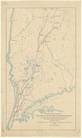
Map of the
Connecticut
River Line
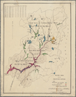
Water shed of the Croton River
note:
… to the
Connecticut
border.
Map showing the line of the N…
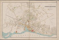
Driving chart of Hartford and…
collection:
Connecticut
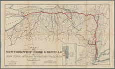
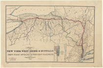
Map of the New York West Shor…
note:
… of
Connecticut
, New Jersey
m
… of
Connecticut
Map of Block Island
note:
Inset map of
Connecticut
, Massachusetts
Map of the New York West Shor…
note:
… of
Connecticut
, New Jersey
Hints for the lay-out of East…
collection:
Connecticut
Map of water shed of Housaton…
Plan of the city of Hartford …
collection:
Connecticut
Milford in 1646: [Connecticut]
collection:
Connecticut
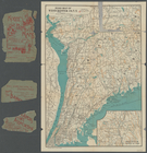
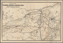
Map of the Fitchburg, Cheshir…
note:
… and
Connecticut
, portions of Maine