Click to visit the main New York Public Library Homepage
The New York Public Library
Digital Collections
About Digital Collections
Browse
Search only public domain materials
Items
Collections
Divisions
Home
Search
Browse
About
Search only public domain materials
Items
Collections
Divisions
Digital Collections
Using Images
Using Data
Search
Filtered keyword search
Show filters
Hide filters
Show Only Public Domain
topic
Railroads
53
Administrative and political divisions
46
Canals
19
Real property
18
Nautical charts
11
More
Less
name
United States Coast Survey
8
G.W. & C.B. Colton & Co
6
Carrère & Hastings
5
Connecticut. Commission on Boundary between the States of New York and Connecticut
5
G.W. Bromley & Co
5
More
Less
collection
Maps of North America
128
Maps of New York City and State
57
Lawrence H. Slaughter Collection of English maps, charts, globes, books and atlases
13
Atlases of the United States
10
A plan of the city of Hartford
5
More
Less
place
Connecticut
122
New York (State)
73
Massachusetts
44
New England
39
Rhode Island
34
More
Less
genre
x
Maps
Cadastral maps
11
Atlases
9
Early maps
6
Plans
5
More
Less
publisher
publisher not identified
29
Case, Lockwood & Brainard Co
5
G.W. & C.B. Colton & Co
5
G.W. Bromley & Co
5
The Commissioners
5
More
Less
division
Map Division
215
General Research Division
5
Wallach Division: Print Collection
2
Rare Book Division
1
type
cartographic
223
still image
1
Date Range
to
223 results found for:
x
Connecticut
Filtering on:
x
Genre
: Maps
Sort by:
Relevance
Title
Date created
Date digitized
Sequence
m
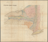
1896
Connecticut
River, Conn., from
A chart of the world : exhibi…
A correct map of
Connecticut
note:
… of
Connecticut
," 1797, v. 1.
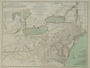
A general map of the middle B…
A general map of the middle B…
… on
Connecticut
River, 1817
note:
… east of
Connecticut
m
A map of Cabotia: comprehendi…
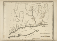
A map of
Connecticut
.
A map of the colonies of
Connecticut
A map of the country in which…
note:
… to the
Connecticut
River.
m
A map of the most inhabited p…
m
A map of the most inhabited p…
m
A map of the most inhabited p…
A map of the New England stat…
A map of the New England stat…
A map of the province of Mass…
A map of the Province of New …
note:
… and the
Connecticut
River.
A map of the states of
Connecticut
and Rho[de Islan]d
A map of the United States an…
note:
… in the Dist. of
Connecticut
."…
A new and accurate map of
Connecticut
note:
… York by
Connecticut
."…
A new and accurate map of the…
note:
…, eastern
Connecticut
A new and accurate map of the…
note:
Covers New England to
Connecticut
River Valley
A new and accurate map of the…
A new and correct map of
Connecticut
A new and correct map of the …
note:
… of the state of
Connecticut
.
A new map of New England, New…
note:
…,
Connecticut
, southeastern New
A new map of New England, New…
note:
…,
Connecticut
, southeastern New
…,
Connecticut
, Rhode Island
…,
Connecticut
, Rhode Island
…,
Connecticut
, Rhode Island
…,
Connecticut
, 1837
A plan of New Haven and harbo…
collection:
Connecticut
Agricultural and geological m…
note:
… from the
Connecticut
… of
Connecticut
and Massachusets
note:
… of
Connecticut
, southeastern
Ancient Windham County: names…
note:
…,
Connecticut
, 1874.
Benham's new map of the city …
note:
…. for the District of
Connecticut
."…
… Squadrons [
Connecticut
]
Boston and Albany Rail Road: …
… York,
Connecticut
… York,
Connecticut
Chart of Long Island Sound, 1…
City of New Haven
collection:
Connecticut
m
…,
Connecticut
m
Colton's new map of Long Isla…
abstract:
… of
Connecticut
.
…, and
Connecticut
…
Connecticut
Connecticut
Connecticut
Connecticut
Connecticut