Click to visit the main New York Public Library Homepage
The New York Public Library
Digital Collections
About Digital Collections
Browse
Search only public domain materials
Items
Collections
Divisions
Home
Search
Browse
About
Search only public domain materials
Items
Collections
Divisions
Digital Collections
Using Images
Using Data
Search
Filtered keyword search
Show filters
Hide filters
Show Only Public Domain
topic
Real property
98
Administrative and political divisions
81
Nautical charts
75
Landowners
72
Railroads
64
More
Less
name
Mitchell, S. Augustus (Samuel Augustus), 1792-1868
69
United States Coast Survey
58
Bache, A. D. (Alexander Dallas), 1806-1867
53
Burr, David H., 1803-1875
32
New York (N.Y.). Department of Parks. Topographical Division
29
More
Less
collection
Maps of North America
299
Maps of New York City and State
99
Atlases of the United States
72
Atlases, gazetteers, guidebooks and other books
52
Lawrence H. Slaughter Collection of English maps, charts, globes, books and atlases
37
More
Less
place
New York (State)
120
United States
66
New York (N.Y.)
55
New York Metropolitan Area
39
New Jersey
32
More
Less
genre
x
Maps
Atlases
62
Nautical charts
49
Cadastral maps
45
Topographic maps
40
More
Less
publisher
S. A. Mitchell, jr
50
The Division
29
U.S. Coast Survey
28
Stone and Clark,
26
publisher not identified
16
More
Less
division
Map Division
604
Rare Book Division
2
George Arents Collection
1
Manuscripts and Archives Division
1
Wallach Division: Print Collection
1
type
cartographic
603
still image
21
text
14
Date Range
to
609 results found for:
x
Tables
Filtering on:
x
Genre
: Maps
Sort by:
Relevance
Title
Date created
Date digitized
Sequence
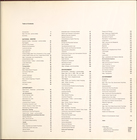
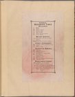
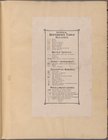
Table
of Contents
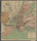
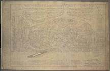
M-T-10-100: Index Map of Cent…
note:
…
table
of coordinates, notes,
table
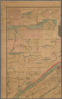
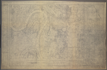
M-T-10-101: [Bounded by West …
note:
…
table
of coordinates, notes,
table
M-T-10-102: [Bounded by East …
note:
…
table
of coordinates, notes,
table
M-T-10-103: [Bounded by West …
note:
…
table
of coordinates, notes,
table
M-T-10-104: [Bounded by East …
note:
…
table
of coordinates, notes,
table
M-T-10-105: [Bounded by West …
note:
…
table
of coordinates, notes,
table
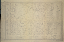
M-T-10-106: [Bounded by North…
note:
…
table
of coordinates, notes,
table
M-T-10-107: [Bounded by West …
note:
…
table
of coordinates, notes,
table
M-T-10-108: [Bounded by North…
note:
…
table
of coordinates, notes,
table
M-T-10-109: [Bounded by West …
note:
…
table
of coordinates, notes,
table
M-T-10-110: [Bounded by Bridl…
note:
…
table
of coordinates, notes,
table
M-T-10-111: [Bounded by West …
note:
…
table
of coordinates, notes,
table
M-T-10-112: [Bounded by Bridl…
note:
…
table
of coordinates, notes,
table
M-T-10-113: [Bounded by West …
note:
…
table
of coordinates, notes,
table
M-T-10-114: [Bounded by Bridl…
note:
…
table
of coordinates, notes,
table
M-T-10-115: [Bounded by West …
note:
…
table
of coordinates, notes,
table
M-T-10-116: [Bounded by East …
note:
…
table
of coordinates, notes,
table
M-T-10-117: [Bounded by Centr…
note:
…
table
of coordinates, notes,
table
M-T-10-118: [Bounded by East …
note:
…
table
of coordinates, notes,
table
M-T-10-119: [Bounded by West …
note:
…
table
of coordinates, notes,
table
M-T-10-120: [Bounded by (The …
note:
…
table
of coordinates, notes,
table
M-T-10-121: [Bounded by West …
note:
…
table
of coordinates, notes,
table
M-T-10-122: [Bounded by (The …
note:
…
table
of coordinates, notes,
table
M-T-10-123: [Bounded by West …
note:
…
table
of coordinates, notes,
table
M-T-10-124: [Bounded by (The …
note:
…
table
of coordinates, notes,
table
M-T-10-125: [Bounded by West …
note:
…
table
of coordinates, notes,
table
M-T-10-126: [Bounded by (The …
note:
…
table
of coordinates, notes,
table
M-T-10-127: [Bounded by Colum…
note:
…
table
of coordinates, notes,
table
M-T-10-128: [Bounded by (The …
note:
…
table
of coordinates, notes,
table
Reference
Table
Reference
Table
Reference
Table
Queens, Vol. 2,
Table
for Corrections
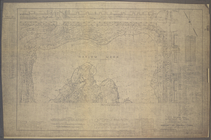
Nome City, Alaska, and vicini…
abstract:
Recto includes
table
of distances
Yukon River, Alaska
note:
Included notes and
tables
.
Map of Alaska
abstract:
…
table
.
University of the State of Ne…
note:
Includes
table
of: "institutions in cities of over
Hydrographic map of Lake Beul…
abstract:
… and soundings. Includes
table
Official map of Nebraska : sh…
abstract:
…. Includes
tables
Map of the borough of Brookly…
abstract:
…. Includes
tables
m
Map of New York City ("greate…
note:
Includes
table
of distances.
m
New map of St. Lawrence Count…
note:
…, illus.,
tables
of county
Trade of the United States wi…
note:
Also includes
table
listing value in dollars
Map of Connecticut
note:
Includes a
table
of 1890 population
The Hawaiian Islands: compile…
abstract:
…, and
table
of distances from
Map of the city of Washington…
note:
Includes
table
of "Width of streets
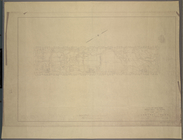
Plan of Boston proper, showin…
note:
Table
of references identifies significance
Map of the city of Washington…
abstract:
…
table
of "Width
m
Rand, McNally and Co.'s gener…
abstract:
Relief shown by hachures. Includes
table
1
2
3
Previous
Next
1
2
3
Previous
Next