Click to visit the main New York Public Library Homepage
The New York Public Library
Digital Collections
About Digital Collections
Browse
Search only public domain materials
Items
Collections
Divisions
Home
Search
Browse
About
Search only public domain materials
Items
Collections
Divisions
Digital Collections
Using Images
Using Data
Search
Filtered keyword search
Show filters
Hide filters
Show Only Public Domain
topic
Astronomy, 1681
53
Geography
53
Mathematics
53
Nautical charts
7
History
6
More
Less
name
Flamsteed, John, 1646-1719
53
Godbid, A
53
Hanway, William
53
Moore, Jonas, Sir, 1617-1679
53
Perkins, Peter, -1680
53
More
Less
collection
Lawrence H. Slaughter Collection of English maps, charts, globes, books and atlases
57
Maps of North America
27
Bancker plans
5
Maps of New York City and State
5
Atlases of the United States
3
More
Less
place
United States
6
Alaska
5
Canada
5
Hawaii
3
New York (N.Y.)
3
More
Less
genre
x
Maps
Bathymetric maps
5
Nautical charts
5
Surveys
5
land surveys
5
More
Less
publisher
Printed by A. Godbid and J. Playford, for R. Scott, bookseller
53
U.S. Light-House Board
5
U.S. Coast Survey
3
Corps of Engineers
2
Davis & Force,
2
More
Less
division
Map Division
93
Manuscripts and Archives Division
5
type
cartographic
97
still image
1
Date Range
to
98 results found for:
x
Williams%2C Peter
Filtering on:
x
Genre
: Maps
Sort by:
Relevance
Title
Date created
Date digitized
Sequence
Explorations in Alaska, 1898 …
note:
…"W.J.
Peters
Alaska Peninsula and Aleutian…
Alaska Peninsula and Aleutian…
Map of Teller Reindeer Statio…
Map of Wilmington Harbor, Cal…
Part of the city of Honolulu,…
General map of the island of …
Oahu, Hawaiian Islands: repro…
Detroit 1820
note:
Peter
B. Porter
m
Niagara 1819
note:
…"
Peter
B. Porter
m
Map of the St. Clair River : …
note:
Peter
B. Porter
Lake St. Clair
note:
Peter
B. Porter
The second section of the sur…
note:
Peter
B. Porter
Plate 30: Map No. 368 [Bounde…
note:
… of the farm of
Peter
Bussing
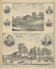
Map of Hon. Wm. L. Scott's es…
General map of the anthracite…
note:
…"Copyright 1884 by
William
A. Ingham
…. of
Peter
P. Davis, Hooper
Upper Geyser Basin
Map of a reconnaissance from …
note:
By Captain
William
Ludlow.
Map showing the distribution …
Campaign map of the Departmen…
Map of military department of…
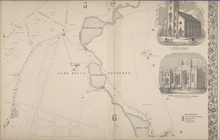
City of Troy [cont.]; St.
Peters
Church
note:
from actual surveys by
William
Barton.
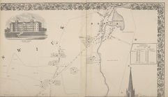
St.
Peters
Collage. ;City of Troy [cont.]
note:
from actual surveys by
William
Barton.
Reconnaissance of the western…
Map illustrating the general …
Geological and topographical …
Military map of Nebraska and …
Reconnaissance of the western…
Preliminary chart of Beaufort…
note:
…"Redd. Drng. by L.D.
Williams
& J.R. Key
Long Island Sound from New Yo…
note:
… / by
Peter
J. Guthorn. 1984
Long Island Sound from New Yo…
note:
… / by
Peter
J. Guthorn. 1984
Map of the country thirty mil…
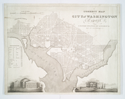
A correct map of the city of …
note:
… of January 1820 by
Peter
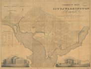
A correct map of the city of …
note:
… of January 1820 by
Peter
To the citizens of Philadelph…
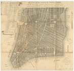
Plan of the city of New-York …
note:
… by
Peter
Maverick.
m
Cedar Street near
Williams
Street
note:
For
Peter
Jay Munro. Bounded by the land
m
Peter
Byvanck's estate near Corlears Hook
note:
… by Blanchard's and
William
m
Bowery Lane
note:
… by
Williams
, Anderson and
Peter
Stuyvesant lands.
m
Lots near Amity Street, Broad…
note:
…,
Peter
William
Livingston
A plan of the attack of Fort …
abstract:
… of commodore Sir
Peter
Parker
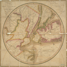
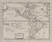
A new and accurate map of Nor…
America.
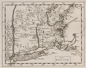
New England.
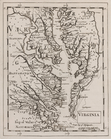
Virginia.
Added title page, vol. 1
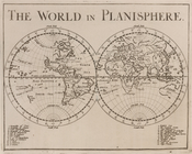
The world in planisphere.
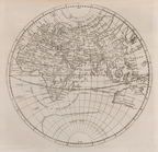
Africa, Europe and Asia.
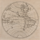
America.